You are here: Home > Network List > UW - Pacific Northwest Regional Seismic Network Stations List
> Station HEBO Mt. Hebo, OR CREST BB SMO > Earthquake Result Viewer
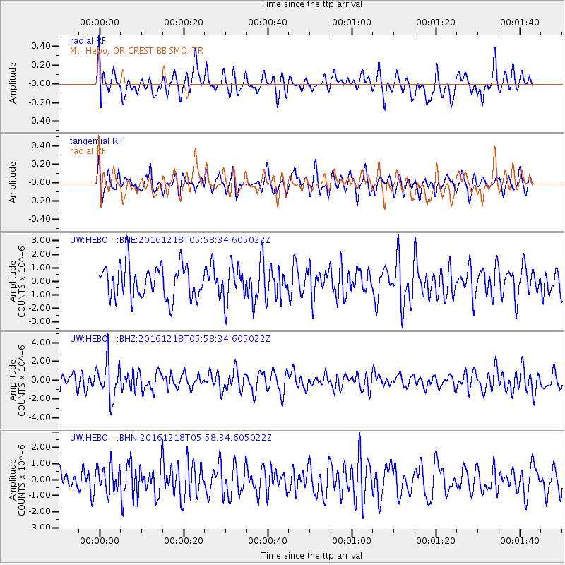
HEBO Mt. Hebo, OR CREST BB SMO - Earthquake Result Viewer
*The percent match for this event was below the threshold and hence no stack was calculated.
| Earthquake location: |
Solomon Islands |
| Earthquake latitude/longitude: |
-10.2/161.2 |
| Earthquake time(UTC): |
2016/12/18 (353) 05:46:25 GMT |
| Earthquake Depth: |
39 km |
| Earthquake Magnitude: |
6.0 Mwp |
| Earthquake Catalog/Contributor: |
NEIC PDE/us |
|
| Network: |
UW Pacific Northwest Regional Seismic Network |
| Station: |
HEBO Mt. Hebo, OR CREST BB SMO |
| Lat/Lon: |
45.21 N/123.76 W |
| Elevation: |
875 m |
|
| Distance: |
86.9 deg |
| Az: |
43.153 deg |
| Baz: |
252.255 deg |
| Ray Param: |
$rayparam |
*The percent match for this event was below the threshold and hence was not used in the summary stack. |
|
| Radial Match: |
53.544083 % |
| Radial Bump: |
400 |
| Transverse Match: |
49.86678 % |
| Transverse Bump: |
400 |
| SOD ConfigId: |
11737051 |
| Insert Time: |
2019-04-26 08:39:08.312 +0000 |
| GWidth: |
2.5 |
| Max Bumps: |
400 |
| Tol: |
0.001 |
|
Signal To Noise
| Channel | StoN | STA | LTA |
| UW:HEBO: :BHZ:20161218T05:58:34.605022Z | 2.6362717 | 1.9850877E-6 | 7.529905E-7 |
| UW:HEBO: :BHN:20161218T05:58:34.605022Z | 0.75880575 | 7.714473E-7 | 1.0166598E-6 |
| UW:HEBO: :BHE:20161218T05:58:34.605022Z | 1.0880857 | 1.3086608E-6 | 1.2027185E-6 |
| Arrivals |
| Ps | |
| PpPs | |
| PsPs/PpSs | |


