You are here: Home > Network List > CI - Caltech Regional Seismic Network Stations List
> Station SWS Sam W. Stewart, Westmorland, CA, USA > Earthquake Result Viewer
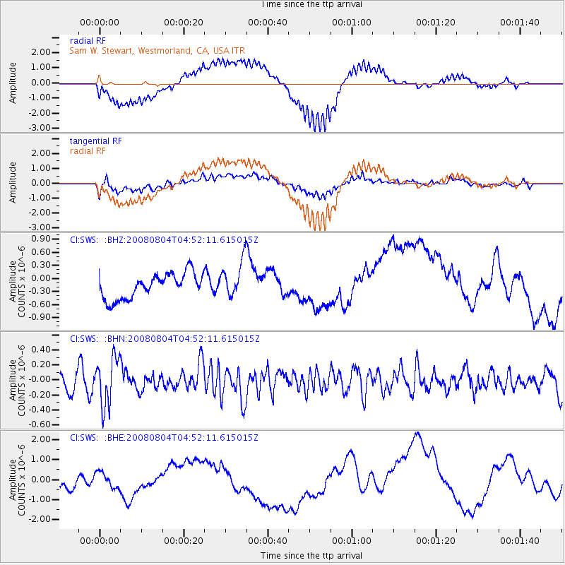
SWS Sam W. Stewart, Westmorland, CA, USA - Earthquake Result Viewer
*The percent match for this event was below the threshold and hence no stack was calculated.
| Earthquake location: |
Kuril Islands |
| Earthquake latitude/longitude: |
49.9/156.4 |
| Earthquake time(UTC): |
2008/08/04 (217) 04:42:14 GMT |
| Earthquake Depth: |
77 km |
| Earthquake Magnitude: |
5.6 MB, 5.8 MW, 5.7 MW |
| Earthquake Catalog/Contributor: |
WHDF/NEIC |
|
| Network: |
CI Caltech Regional Seismic Network |
| Station: |
SWS Sam W. Stewart, Westmorland, CA, USA |
| Lat/Lon: |
32.94 N/115.80 W |
| Elevation: |
140 m |
|
| Distance: |
64.3 deg |
| Az: |
68.797 deg |
| Baz: |
314.139 deg |
| Ray Param: |
$rayparam |
*The percent match for this event was below the threshold and hence was not used in the summary stack. |
|
| Radial Match: |
66.31998 % |
| Radial Bump: |
400 |
| Transverse Match: |
58.636093 % |
| Transverse Bump: |
400 |
| SOD ConfigId: |
2504 |
| Insert Time: |
2010-03-05 20:38:50.620 +0000 |
| GWidth: |
2.5 |
| Max Bumps: |
400 |
| Tol: |
0.001 |
|
Signal To Noise
| Channel | StoN | STA | LTA |
| CI:SWS: :BHN:20080804T04:52:11.615015Z | 2.4831681 | 3.2199713E-7 | 1.296719E-7 |
| CI:SWS: :BHE:20080804T04:52:11.615015Z | 0.896571 | 6.772053E-7 | 7.5532813E-7 |
| CI:SWS: :BHZ:20080804T04:52:11.615015Z | 1.5433066 | 4.4184208E-7 | 2.8629572E-7 |
| Arrivals |
| Ps | |
| PpPs | |
| PsPs/PpSs | |


