You are here: Home > Network List > TA - USArray Transportable Network (new EarthScope stations) Stations List
> Station D25K Kavik River, AK, USA > Earthquake Result Viewer
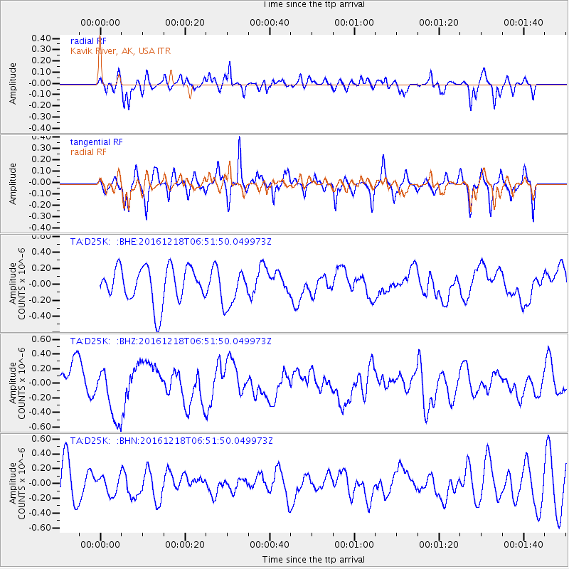
D25K Kavik River, AK, USA - Earthquake Result Viewer
*The percent match for this event was below the threshold and hence no stack was calculated.
| Earthquake location: |
Solomon Islands |
| Earthquake latitude/longitude: |
-6.3/154.3 |
| Earthquake time(UTC): |
2016/12/18 (353) 06:39:43 GMT |
| Earthquake Depth: |
10 km |
| Earthquake Magnitude: |
5.8 Mww |
| Earthquake Catalog/Contributor: |
NEIC PDE/us |
|
| Network: |
TA USArray Transportable Network (new EarthScope stations) |
| Station: |
D25K Kavik River, AK, USA |
| Lat/Lon: |
69.32 N/146.38 W |
| Elevation: |
770 m |
|
| Distance: |
85.5 deg |
| Az: |
17.837 deg |
| Baz: |
239.001 deg |
| Ray Param: |
$rayparam |
*The percent match for this event was below the threshold and hence was not used in the summary stack. |
|
| Radial Match: |
49.475945 % |
| Radial Bump: |
400 |
| Transverse Match: |
62.050484 % |
| Transverse Bump: |
344 |
| SOD ConfigId: |
11737051 |
| Insert Time: |
2019-04-26 08:46:06.573 +0000 |
| GWidth: |
2.5 |
| Max Bumps: |
400 |
| Tol: |
0.001 |
|
Signal To Noise
| Channel | StoN | STA | LTA |
| TA:D25K: :BHZ:20161218T06:51:50.049973Z | 2.0696497 | 3.760575E-7 | 1.8170104E-7 |
| TA:D25K: :BHN:20161218T06:51:50.049973Z | 0.5942653 | 1.2136208E-7 | 2.0422206E-7 |
| TA:D25K: :BHE:20161218T06:51:50.049973Z | 1.0247874 | 2.2721231E-7 | 2.2171652E-7 |
| Arrivals |
| Ps | |
| PpPs | |
| PsPs/PpSs | |


