You are here: Home > Network List > UW - Pacific Northwest Regional Seismic Network Stations List
> Station MRBL Marblemount, WA, USA > Earthquake Result Viewer
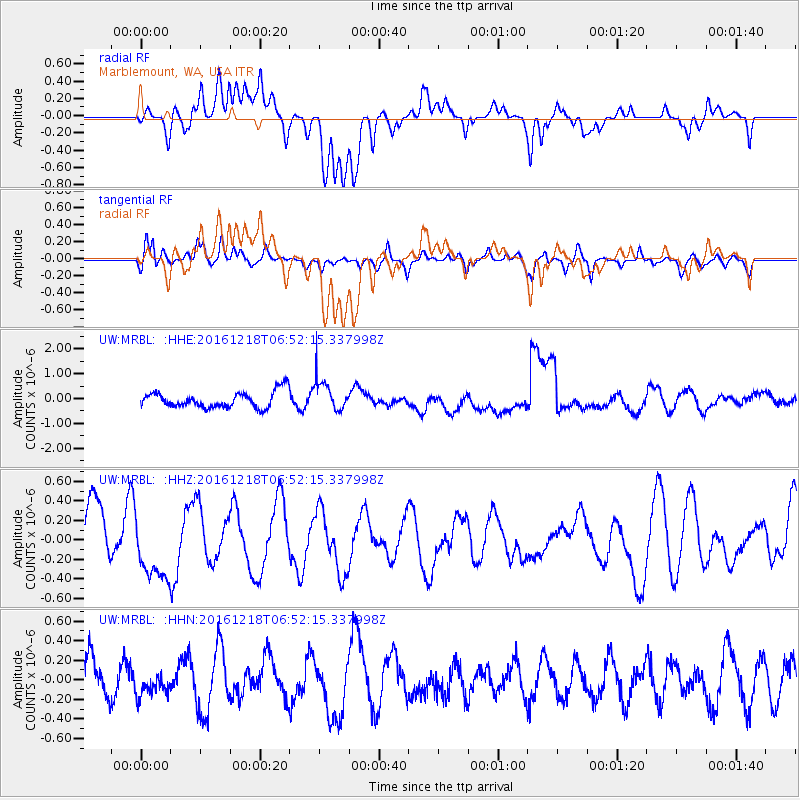
MRBL Marblemount, WA, USA - Earthquake Result Viewer
*The percent match for this event was below the threshold and hence no stack was calculated.
| Earthquake location: |
Solomon Islands |
| Earthquake latitude/longitude: |
-6.3/154.3 |
| Earthquake time(UTC): |
2016/12/18 (353) 06:39:43 GMT |
| Earthquake Depth: |
10 km |
| Earthquake Magnitude: |
5.8 Mww |
| Earthquake Catalog/Contributor: |
NEIC PDE/us |
|
| Network: |
UW Pacific Northwest Regional Seismic Network |
| Station: |
MRBL Marblemount, WA, USA |
| Lat/Lon: |
48.52 N/121.48 W |
| Elevation: |
75 m |
|
| Distance: |
90.8 deg |
| Az: |
41.416 deg |
| Baz: |
261.48 deg |
| Ray Param: |
$rayparam |
*The percent match for this event was below the threshold and hence was not used in the summary stack. |
|
| Radial Match: |
53.54586 % |
| Radial Bump: |
400 |
| Transverse Match: |
58.334908 % |
| Transverse Bump: |
400 |
| SOD ConfigId: |
11737051 |
| Insert Time: |
2019-04-26 08:46:50.929 +0000 |
| GWidth: |
2.5 |
| Max Bumps: |
400 |
| Tol: |
0.001 |
|
Signal To Noise
| Channel | StoN | STA | LTA |
| UW:MRBL: :HHZ:20161218T06:52:15.337998Z | 1.2573655 | 3.2612954E-7 | 2.593753E-7 |
| UW:MRBL: :HHN:20161218T06:52:15.337998Z | 0.43434155 | 1.2273091E-7 | 2.8256775E-7 |
| UW:MRBL: :HHE:20161218T06:52:15.337998Z | 1.8430935 | 5.9685925E-7 | 3.2383556E-7 |
| Arrivals |
| Ps | |
| PpPs | |
| PsPs/PpSs | |


