You are here: Home > Network List > AK - Alaska Regional Network Stations List
> Station CUT Chulitna, AK, USA > Earthquake Result Viewer
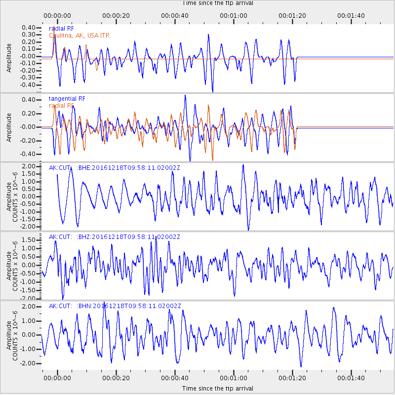
CUT Chulitna, AK, USA - Earthquake Result Viewer
*The percent match for this event was below the threshold and hence no stack was calculated.
| Earthquake location: |
W. Caroline Islands, Micronesia |
| Earthquake latitude/longitude: |
8.3/137.7 |
| Earthquake time(UTC): |
2016/12/18 (353) 09:47:08 GMT |
| Earthquake Depth: |
29 km |
| Earthquake Magnitude: |
6.5 Mi |
| Earthquake Catalog/Contributor: |
NEIC PDE/at |
|
| Network: |
AK Alaska Regional Network |
| Station: |
CUT Chulitna, AK, USA |
| Lat/Lon: |
62.41 N/150.26 W |
| Elevation: |
574 m |
|
| Distance: |
74.4 deg |
| Az: |
27.381 deg |
| Baz: |
257.813 deg |
| Ray Param: |
$rayparam |
*The percent match for this event was below the threshold and hence was not used in the summary stack. |
|
| Radial Match: |
59.97882 % |
| Radial Bump: |
359 |
| Transverse Match: |
55.86516 % |
| Transverse Bump: |
392 |
| SOD ConfigId: |
11737051 |
| Insert Time: |
2019-04-26 08:48:50.779 +0000 |
| GWidth: |
2.5 |
| Max Bumps: |
400 |
| Tol: |
0.001 |
|
Signal To Noise
| Channel | StoN | STA | LTA |
| AK:CUT: :BHZ:20161218T09:58:11.02002Z | 2.4641888 | 9.705153E-7 | 3.9384778E-7 |
| AK:CUT: :BHN:20161218T09:58:11.02002Z | 1.0293584 | 6.301749E-7 | 6.122017E-7 |
| AK:CUT: :BHE:20161218T09:58:11.02002Z | 0.7804576 | 6.6236885E-7 | 8.4869293E-7 |
| Arrivals |
| Ps | |
| PpPs | |
| PsPs/PpSs | |


