You are here: Home > Network List > CI - Caltech Regional Seismic Network Stations List
> Station BEL Belle Mtn, Joshua Tree National Park, CA, USA > Earthquake Result Viewer
BEL Belle Mtn, Joshua Tree National Park, CA, USA - Earthquake Result Viewer

| Earthquake location: |
Chile-Bolivia Border Region |
| Earthquake latitude/longitude: |
-22.3/-67.9 |
| Earthquake time(UTC): |
2005/11/17 (321) 19:26:56 GMT |
| Earthquake Depth: |
163 km |
| Earthquake Magnitude: |
6.0 MB, 6.9 MW, 6.8 MW |
| Earthquake Catalog/Contributor: |
WHDF/NEIC |
|
| Network: |
CI Caltech Regional Seismic Network |
| Station: |
BEL Belle Mtn, Joshua Tree National Park, CA, USA |
| Lat/Lon: |
34.00 N/116.00 W |
| Elevation: |
1388 m |
|
| Distance: |
72.3 deg |
| Az: |
319.529 deg |
| Baz: |
133.66 deg |
| Ray Param: |
0.053304717 |
| Estimated Moho Depth: |
68.5 km |
| Estimated Crust Vp/Vs: |
2.04 |
| Assumed Crust Vp: |
6.276 km/s |
| Estimated Crust Vs: |
3.073 km/s |
| Estimated Crust Poisson's Ratio: |
0.34 |
|
| Radial Match: |
95.503265 % |
| Radial Bump: |
400 |
| Transverse Match: |
85.7476 % |
| Transverse Bump: |
400 |
| SOD ConfigId: |
2422 |
| Insert Time: |
2010-03-05 20:39:58.808 +0000 |
| GWidth: |
2.5 |
| Max Bumps: |
400 |
| Tol: |
0.001 |
|
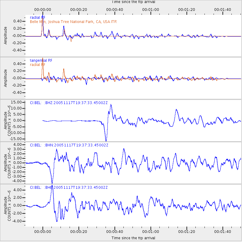
Signal To Noise
| Channel | StoN | STA | LTA |
| CI:BEL: :BHN:20051117T19:37:33.45002Z | 7.0006766 | 9.901773E-7 | 1.4144022E-7 |
| CI:BEL: :BHE:20051117T19:37:33.45002Z | 8.213158 | 1.1712908E-6 | 1.426115E-7 |
| CI:BEL: :BHZ:20051117T19:37:33.45002Z | 21.614548 | 3.7468997E-6 | 1.7335083E-7 |
| Arrivals |
| Ps | 12 SECOND |
| PpPs | 32 SECOND |
| PsPs/PpSs | 44 SECOND |


