You are here: Home > Network List > CI - Caltech Regional Seismic Network Stations List
> Station BFS Mt Baldy Forest Station > Earthquake Result Viewer
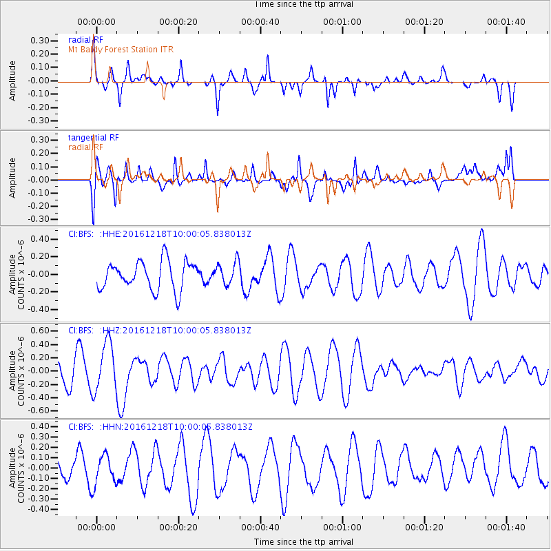
BFS Mt Baldy Forest Station - Earthquake Result Viewer
*The percent match for this event was below the threshold and hence no stack was calculated.
| Earthquake location: |
W. Caroline Islands, Micronesia |
| Earthquake latitude/longitude: |
8.3/137.7 |
| Earthquake time(UTC): |
2016/12/18 (353) 09:47:08 GMT |
| Earthquake Depth: |
29 km |
| Earthquake Magnitude: |
6.5 Mi |
| Earthquake Catalog/Contributor: |
NEIC PDE/at |
|
| Network: |
CI Caltech Regional Seismic Network |
| Station: |
BFS Mt Baldy Forest Station |
| Lat/Lon: |
34.24 N/117.66 W |
| Elevation: |
1312 m |
|
| Distance: |
97.3 deg |
| Az: |
53.909 deg |
| Baz: |
285.131 deg |
| Ray Param: |
$rayparam |
*The percent match for this event was below the threshold and hence was not used in the summary stack. |
|
| Radial Match: |
49.017647 % |
| Radial Bump: |
300 |
| Transverse Match: |
56.196266 % |
| Transverse Bump: |
400 |
| SOD ConfigId: |
11737051 |
| Insert Time: |
2019-04-26 08:50:23.738 +0000 |
| GWidth: |
2.5 |
| Max Bumps: |
400 |
| Tol: |
0.001 |
|
Signal To Noise
| Channel | StoN | STA | LTA |
| CI:BFS: :HHZ:20161218T10:00:05.838013Z | 1.8816596 | 3.745394E-7 | 1.9904736E-7 |
| CI:BFS: :HHN:20161218T10:00:05.838013Z | 0.8236299 | 1.3566532E-7 | 1.6471635E-7 |
| CI:BFS: :HHE:20161218T10:00:05.838013Z | 0.8131461 | 1.2951591E-7 | 1.5927753E-7 |
| Arrivals |
| Ps | |
| PpPs | |
| PsPs/PpSs | |


