You are here: Home > Network List > PF - Volcanologic Network of Piton de Fournaise-OVPF Stations List
> Station BON Bory Nord > Earthquake Result Viewer
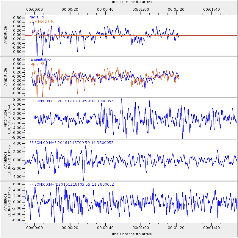
BON Bory Nord - Earthquake Result Viewer
*The percent match for this event was below the threshold and hence no stack was calculated.
| Earthquake location: |
W. Caroline Islands, Micronesia |
| Earthquake latitude/longitude: |
8.3/137.7 |
| Earthquake time(UTC): |
2016/12/18 (353) 09:47:08 GMT |
| Earthquake Depth: |
29 km |
| Earthquake Magnitude: |
6.5 Mi |
| Earthquake Catalog/Contributor: |
NEIC PDE/at |
|
| Network: |
PF Volcanologic Network of Piton de Fournaise-OVPF |
| Station: |
BON Bory Nord |
| Lat/Lon: |
21.24 S/55.71 E |
| Elevation: |
2552 m |
|
| Distance: |
85.6 deg |
| Az: |
247.902 deg |
| Baz: |
79.397 deg |
| Ray Param: |
$rayparam |
*The percent match for this event was below the threshold and hence was not used in the summary stack. |
|
| Radial Match: |
69.37037 % |
| Radial Bump: |
400 |
| Transverse Match: |
54.85835 % |
| Transverse Bump: |
400 |
| SOD ConfigId: |
11737051 |
| Insert Time: |
2019-04-26 08:52:16.652 +0000 |
| GWidth: |
2.5 |
| Max Bumps: |
400 |
| Tol: |
0.001 |
|
Signal To Noise
| Channel | StoN | STA | LTA |
| PF:BON:00:HHZ:20161218T09:59:11.380005Z | 2.5450919 | 1.4325896E-6 | 5.6288326E-7 |
| PF:BON:00:HHN:20161218T09:59:11.380005Z | 1.5046643 | 2.4820545E-6 | 1.6495735E-6 |
| PF:BON:00:HHE:20161218T09:59:11.380005Z | 1.1201268 | 1.4884365E-6 | 1.3288106E-6 |
| Arrivals |
| Ps | |
| PpPs | |
| PsPs/PpSs | |


