You are here: Home > Network List > TA - USArray Transportable Network (new EarthScope stations) Stations List
> Station G21K Allakaket, AK, USA > Earthquake Result Viewer
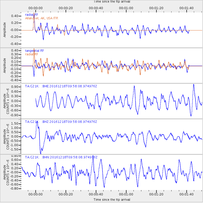
G21K Allakaket, AK, USA - Earthquake Result Viewer
*The percent match for this event was below the threshold and hence no stack was calculated.
| Earthquake location: |
W. Caroline Islands, Micronesia |
| Earthquake latitude/longitude: |
8.3/137.7 |
| Earthquake time(UTC): |
2016/12/18 (353) 09:47:08 GMT |
| Earthquake Depth: |
29 km |
| Earthquake Magnitude: |
6.5 Mi |
| Earthquake Catalog/Contributor: |
NEIC PDE/at |
|
| Network: |
TA USArray Transportable Network (new EarthScope stations) |
| Station: |
G21K Allakaket, AK, USA |
| Lat/Lon: |
66.52 N/153.51 W |
| Elevation: |
446 m |
|
| Distance: |
74.0 deg |
| Az: |
22.866 deg |
| Baz: |
253.66 deg |
| Ray Param: |
$rayparam |
*The percent match for this event was below the threshold and hence was not used in the summary stack. |
|
| Radial Match: |
65.20194 % |
| Radial Bump: |
400 |
| Transverse Match: |
59.8889 % |
| Transverse Bump: |
400 |
| SOD ConfigId: |
11737051 |
| Insert Time: |
2019-04-26 08:52:53.382 +0000 |
| GWidth: |
2.5 |
| Max Bumps: |
400 |
| Tol: |
0.001 |
|
Signal To Noise
| Channel | StoN | STA | LTA |
| TA:G21K: :BHZ:20161218T09:58:08.974976Z | 4.396408 | 1.2726744E-6 | 2.8948048E-7 |
| TA:G21K: :BHN:20161218T09:58:08.974976Z | 0.71576035 | 2.676644E-7 | 3.7395816E-7 |
| TA:G21K: :BHE:20161218T09:58:08.974976Z | 0.62864375 | 2.082982E-7 | 3.313454E-7 |
| Arrivals |
| Ps | |
| PpPs | |
| PsPs/PpSs | |


