You are here: Home > Network List > TA - USArray Transportable Network (new EarthScope stations) Stations List
> Station R11A Troy Canyon, Currant, NV, USA > Earthquake Result Viewer
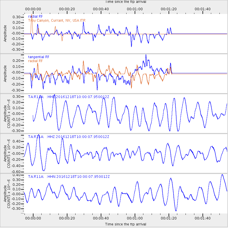
R11A Troy Canyon, Currant, NV, USA - Earthquake Result Viewer
*The percent match for this event was below the threshold and hence no stack was calculated.
| Earthquake location: |
W. Caroline Islands, Micronesia |
| Earthquake latitude/longitude: |
8.3/137.7 |
| Earthquake time(UTC): |
2016/12/18 (353) 09:47:08 GMT |
| Earthquake Depth: |
29 km |
| Earthquake Magnitude: |
6.5 Mi |
| Earthquake Catalog/Contributor: |
NEIC PDE/at |
|
| Network: |
TA USArray Transportable Network (new EarthScope stations) |
| Station: |
R11A Troy Canyon, Currant, NV, USA |
| Lat/Lon: |
38.35 N/115.59 W |
| Elevation: |
1756 m |
|
| Distance: |
97.8 deg |
| Az: |
49.466 deg |
| Baz: |
286.936 deg |
| Ray Param: |
$rayparam |
*The percent match for this event was below the threshold and hence was not used in the summary stack. |
|
| Radial Match: |
40.854446 % |
| Radial Bump: |
361 |
| Transverse Match: |
45.106678 % |
| Transverse Bump: |
400 |
| SOD ConfigId: |
11737051 |
| Insert Time: |
2019-04-26 08:53:35.679 +0000 |
| GWidth: |
2.5 |
| Max Bumps: |
400 |
| Tol: |
0.001 |
|
Signal To Noise
| Channel | StoN | STA | LTA |
| TA:R11A: :HHZ:20161218T10:00:07.950012Z | 2.8452716 | 3.7357168E-7 | 1.3129562E-7 |
| TA:R11A: :HHN:20161218T10:00:07.950012Z | 0.44418126 | 8.21024E-8 | 1.8483986E-7 |
| TA:R11A: :HHE:20161218T10:00:07.950012Z | 0.6263614 | 1.0615665E-7 | 1.6948147E-7 |
| Arrivals |
| Ps | |
| PpPs | |
| PsPs/PpSs | |


