You are here: Home > Network List > TJ - Tajikistan National Seismic Network Stations List
> Station GARM Garm, Tajikistan > Earthquake Result Viewer
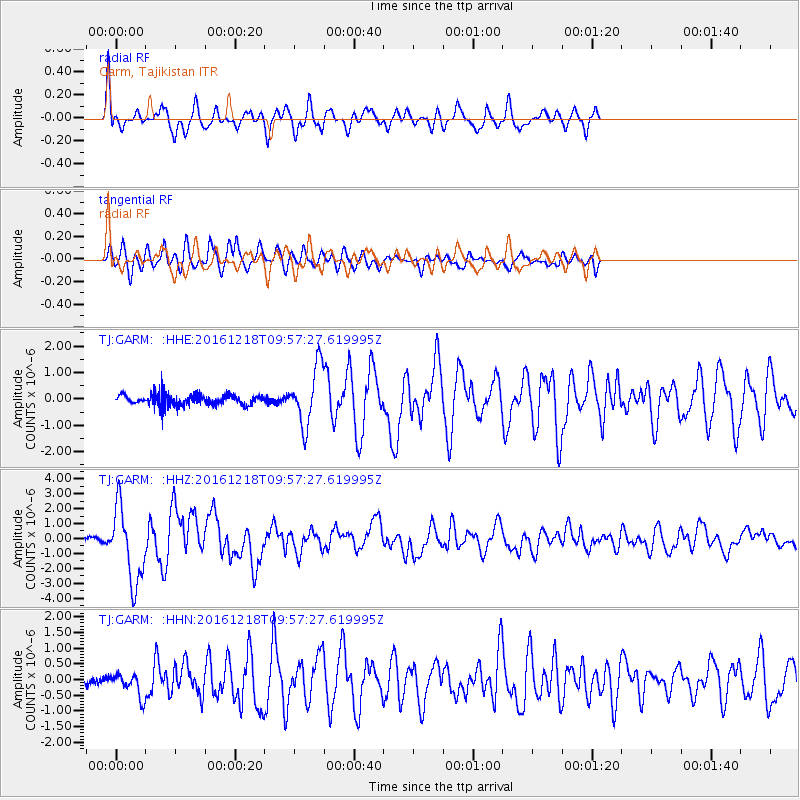
GARM Garm, Tajikistan - Earthquake Result Viewer
*The percent match for this event was below the threshold and hence no stack was calculated.
| Earthquake location: |
W. Caroline Islands, Micronesia |
| Earthquake latitude/longitude: |
8.3/137.7 |
| Earthquake time(UTC): |
2016/12/18 (353) 09:47:08 GMT |
| Earthquake Depth: |
29 km |
| Earthquake Magnitude: |
6.5 Mi |
| Earthquake Catalog/Contributor: |
NEIC PDE/at |
|
| Network: |
TJ Tajikistan National Seismic Network |
| Station: |
GARM Garm, Tajikistan |
| Lat/Lon: |
39.00 N/70.32 E |
| Elevation: |
1305 m |
|
| Distance: |
67.3 deg |
| Az: |
308.751 deg |
| Baz: |
97.901 deg |
| Ray Param: |
$rayparam |
*The percent match for this event was below the threshold and hence was not used in the summary stack. |
|
| Radial Match: |
76.25107 % |
| Radial Bump: |
400 |
| Transverse Match: |
68.93184 % |
| Transverse Bump: |
400 |
| SOD ConfigId: |
11737051 |
| Insert Time: |
2019-04-26 08:53:42.837 +0000 |
| GWidth: |
2.5 |
| Max Bumps: |
400 |
| Tol: |
0.001 |
|
Signal To Noise
| Channel | StoN | STA | LTA |
| TJ:GARM: :HHZ:20161218T09:57:27.619995Z | 11.169578 | 2.5176055E-6 | 2.2539844E-7 |
| TJ:GARM: :HHN:20161218T09:57:27.619995Z | 1.7881689 | 3.699911E-7 | 2.069106E-7 |
| TJ:GARM: :HHE:20161218T09:57:27.619995Z | 6.001593 | 1.2023502E-6 | 2.0033849E-7 |
| Arrivals |
| Ps | |
| PpPs | |
| PsPs/PpSs | |


