You are here: Home > Network List > IU - Global Seismograph Network (GSN - IRIS/USGS) Stations List
> Station CTAO Charters Towers, Australia > Earthquake Result Viewer
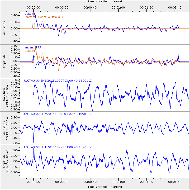
CTAO Charters Towers, Australia - Earthquake Result Viewer
*The percent match for this event was below the threshold and hence no stack was calculated.
| Earthquake location: |
Rat Islands, Aleutian Islands |
| Earthquake latitude/longitude: |
51.8/178.5 |
| Earthquake time(UTC): |
2015/10/29 (302) 02:49:28 GMT |
| Earthquake Depth: |
88 km |
| Earthquake Magnitude: |
5.6 MB |
| Earthquake Catalog/Contributor: |
NEIC PDE/NEIC COMCAT |
|
| Network: |
IU Global Seismograph Network (GSN - IRIS/USGS) |
| Station: |
CTAO Charters Towers, Australia |
| Lat/Lon: |
20.09 S/146.25 E |
| Elevation: |
357 m |
|
| Distance: |
77.0 deg |
| Az: |
210.995 deg |
| Baz: |
19.883 deg |
| Ray Param: |
$rayparam |
*The percent match for this event was below the threshold and hence was not used in the summary stack. |
|
| Radial Match: |
61.87364 % |
| Radial Bump: |
400 |
| Transverse Match: |
56.47913 % |
| Transverse Bump: |
400 |
| SOD ConfigId: |
1259291 |
| Insert Time: |
2015-11-12 03:01:08.854 +0000 |
| GWidth: |
2.5 |
| Max Bumps: |
400 |
| Tol: |
0.001 |
|
Signal To Noise
| Channel | StoN | STA | LTA |
| IU:CTAO:00:BHZ:20151029T03:00:40.169011Z | 1.3289112 | 1.620908E-7 | 1.2197263E-7 |
| IU:CTAO:00:BH1:20151029T03:00:40.169011Z | 1.3304542 | 1.1816191E-7 | 8.88132E-8 |
| IU:CTAO:00:BH2:20151029T03:00:40.169011Z | 0.79107237 | 7.419447E-8 | 9.378973E-8 |
| Arrivals |
| Ps | |
| PpPs | |
| PsPs/PpSs | |


