You are here: Home > Network List > CN - Canadian National Seismograph Network Stations List
> Station INK INUVIK, NT > Earthquake Result Viewer
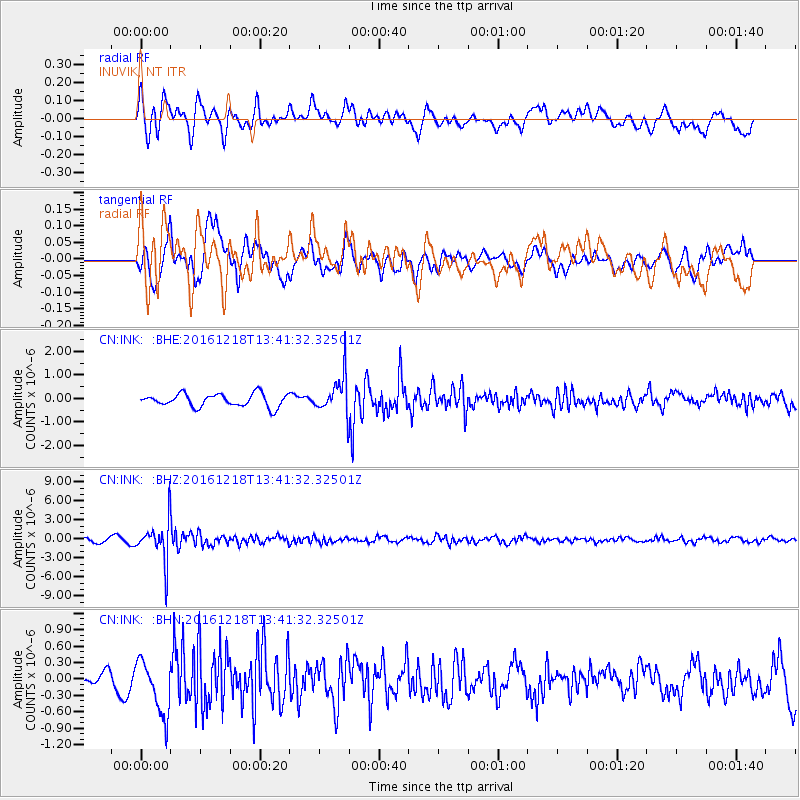
INK INUVIK, NT - Earthquake Result Viewer
*The percent match for this event was below the threshold and hence no stack was calculated.
| Earthquake location: |
Peru-Brazil Border Region |
| Earthquake latitude/longitude: |
-10.0/-71.0 |
| Earthquake time(UTC): |
2016/12/18 (353) 13:30:11 GMT |
| Earthquake Depth: |
619 km |
| Earthquake Magnitude: |
6.4 Mww |
| Earthquake Catalog/Contributor: |
NEIC PDE/us |
|
| Network: |
CN Canadian National Seismograph Network |
| Station: |
INK INUVIK, NT |
| Lat/Lon: |
68.31 N/133.53 W |
| Elevation: |
44 m |
|
| Distance: |
89.5 deg |
| Az: |
340.733 deg |
| Baz: |
119.038 deg |
| Ray Param: |
$rayparam |
*The percent match for this event was below the threshold and hence was not used in the summary stack. |
|
| Radial Match: |
67.225914 % |
| Radial Bump: |
400 |
| Transverse Match: |
60.984947 % |
| Transverse Bump: |
400 |
| SOD ConfigId: |
11737051 |
| Insert Time: |
2019-04-26 09:05:21.459 +0000 |
| GWidth: |
2.5 |
| Max Bumps: |
400 |
| Tol: |
0.001 |
|
Signal To Noise
| Channel | StoN | STA | LTA |
| CN:INK: :BHZ:20161218T13:41:32.32501Z | 9.652115 | 3.0981914E-6 | 3.2098578E-7 |
| CN:INK: :BHN:20161218T13:41:32.32501Z | 3.8360772 | 5.000291E-7 | 1.3034908E-7 |
| CN:INK: :BHE:20161218T13:41:32.32501Z | 3.001354 | 8.253018E-7 | 2.7497651E-7 |
| Arrivals |
| Ps | |
| PpPs | |
| PsPs/PpSs | |


