You are here: Home > Network List > US - United States National Seismic Network Stations List
> Station BOZ Bozeman, Montana, USA > Earthquake Result Viewer
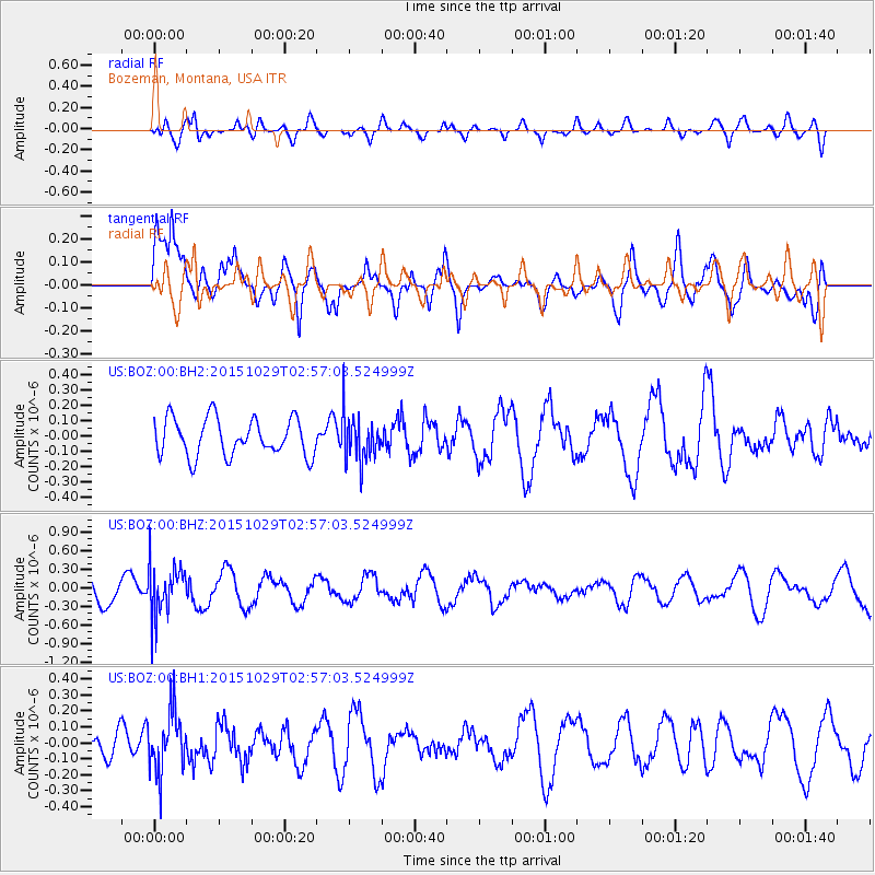
BOZ Bozeman, Montana, USA - Earthquake Result Viewer
*The percent match for this event was below the threshold and hence no stack was calculated.
| Earthquake location: |
Rat Islands, Aleutian Islands |
| Earthquake latitude/longitude: |
51.8/178.5 |
| Earthquake time(UTC): |
2015/10/29 (302) 02:49:28 GMT |
| Earthquake Depth: |
88 km |
| Earthquake Magnitude: |
5.6 MB |
| Earthquake Catalog/Contributor: |
NEIC PDE/NEIC COMCAT |
|
| Network: |
US United States National Seismic Network |
| Station: |
BOZ Bozeman, Montana, USA |
| Lat/Lon: |
45.65 N/111.63 W |
| Elevation: |
1589 m |
|
| Distance: |
44.9 deg |
| Az: |
68.985 deg |
| Baz: |
304.305 deg |
| Ray Param: |
$rayparam |
*The percent match for this event was below the threshold and hence was not used in the summary stack. |
|
| Radial Match: |
50.40019 % |
| Radial Bump: |
400 |
| Transverse Match: |
66.97858 % |
| Transverse Bump: |
400 |
| SOD ConfigId: |
1259291 |
| Insert Time: |
2015-11-12 03:03:42.790 +0000 |
| GWidth: |
2.5 |
| Max Bumps: |
400 |
| Tol: |
0.001 |
|
Signal To Noise
| Channel | StoN | STA | LTA |
| US:BOZ:00:BHZ:20151029T02:57:03.524999Z | 2.1174037 | 4.132239E-7 | 1.9515592E-7 |
| US:BOZ:00:BH1:20151029T02:57:03.524999Z | 0.9136328 | 1.9105013E-7 | 2.0911041E-7 |
| US:BOZ:00:BH2:20151029T02:57:03.524999Z | 1.2546954 | 1.5293239E-7 | 1.2188806E-7 |
| Arrivals |
| Ps | |
| PpPs | |
| PsPs/PpSs | |


