You are here: Home > Network List > LD - Lamont-Doherty Cooperative Seismographic Network Stations List
> Station GEDE Greenville, DE, USA > Earthquake Result Viewer
GEDE Greenville, DE, USA - Earthquake Result Viewer
*The percent match for this event was below the threshold and hence no stack was calculated.
| Earthquake location: |
Peru-Brazil Border Region |
| Earthquake latitude/longitude: |
-10.0/-71.0 |
| Earthquake time(UTC): |
2016/12/18 (353) 13:30:11 GMT |
| Earthquake Depth: |
619 km |
| Earthquake Magnitude: |
6.4 Mww |
| Earthquake Catalog/Contributor: |
NEIC PDE/us |
|
| Network: |
LD Lamont-Doherty Cooperative Seismographic Network |
| Station: |
GEDE Greenville, DE, USA |
| Lat/Lon: |
39.81 N/75.64 W |
| Elevation: |
105 m |
|
| Distance: |
49.7 deg |
| Az: |
355.284 deg |
| Baz: |
173.965 deg |
| Ray Param: |
$rayparam |
*The percent match for this event was below the threshold and hence was not used in the summary stack. |
|
| Radial Match: |
50.87923 % |
| Radial Bump: |
400 |
| Transverse Match: |
66.84996 % |
| Transverse Bump: |
400 |
| SOD ConfigId: |
11737051 |
| Insert Time: |
2019-04-26 09:07:04.805 +0000 |
| GWidth: |
2.5 |
| Max Bumps: |
400 |
| Tol: |
0.001 |
|
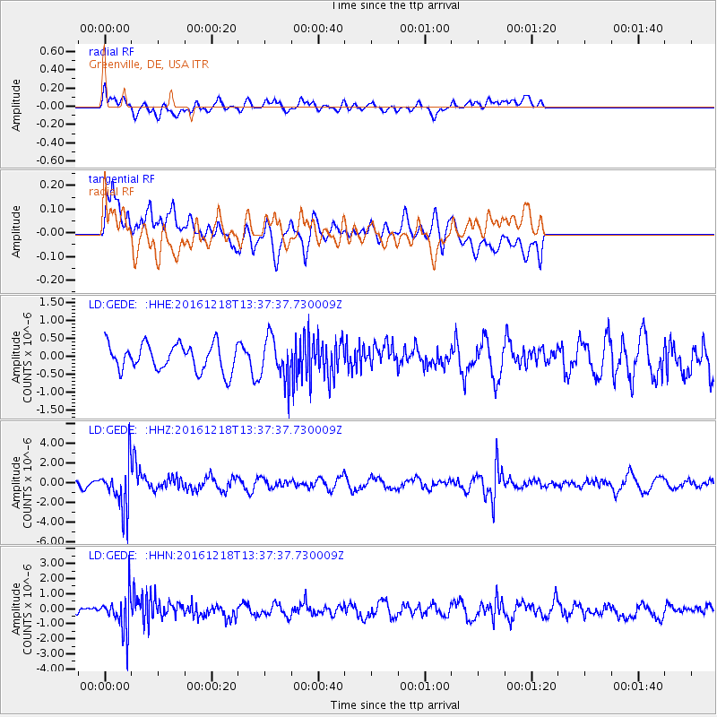
Signal To Noise
| Channel | StoN | STA | LTA |
| LD:GEDE: :HHZ:20161218T13:37:37.730009Z | 4.642445 | 2.2558286E-6 | 4.8591386E-7 |
| LD:GEDE: :HHN:20161218T13:37:37.730009Z | 6.428262 | 1.1891136E-6 | 1.8498213E-7 |
| LD:GEDE: :HHE:20161218T13:37:37.730009Z | 1.6267713 | 6.02052E-7 | 3.700901E-7 |
| Arrivals |
| Ps | |
| PpPs | |
| PsPs/PpSs | |


