You are here: Home > Network List > US - United States National Seismic Network Stations List
> Station CBKS Cedar Bluff, Kansas, USA > Earthquake Result Viewer
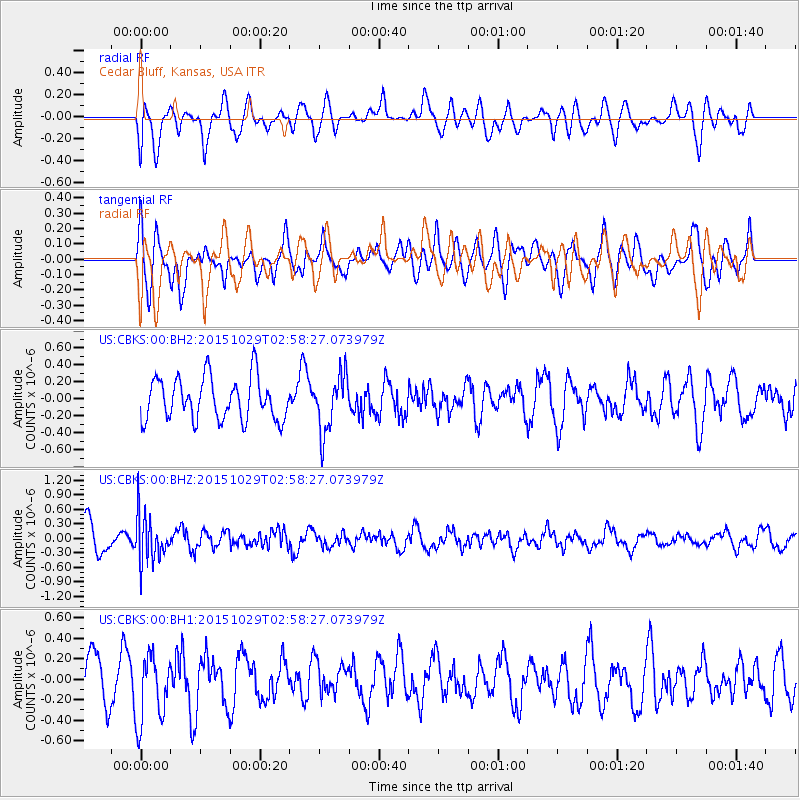
CBKS Cedar Bluff, Kansas, USA - Earthquake Result Viewer
*The percent match for this event was below the threshold and hence no stack was calculated.
| Earthquake location: |
Rat Islands, Aleutian Islands |
| Earthquake latitude/longitude: |
51.8/178.5 |
| Earthquake time(UTC): |
2015/10/29 (302) 02:49:28 GMT |
| Earthquake Depth: |
88 km |
| Earthquake Magnitude: |
5.6 MB |
| Earthquake Catalog/Contributor: |
NEIC PDE/NEIC COMCAT |
|
| Network: |
US United States National Seismic Network |
| Station: |
CBKS Cedar Bluff, Kansas, USA |
| Lat/Lon: |
38.81 N/99.74 W |
| Elevation: |
677 m |
|
| Distance: |
56.0 deg |
| Az: |
68.82 deg |
| Baz: |
312.193 deg |
| Ray Param: |
$rayparam |
*The percent match for this event was below the threshold and hence was not used in the summary stack. |
|
| Radial Match: |
55.757984 % |
| Radial Bump: |
400 |
| Transverse Match: |
58.045506 % |
| Transverse Bump: |
400 |
| SOD ConfigId: |
1259291 |
| Insert Time: |
2015-11-12 03:03:43.610 +0000 |
| GWidth: |
2.5 |
| Max Bumps: |
400 |
| Tol: |
0.001 |
|
Signal To Noise
| Channel | StoN | STA | LTA |
| US:CBKS:00:BHZ:20151029T02:58:27.073979Z | 2.1427937 | 4.6439192E-7 | 2.1672264E-7 |
| US:CBKS:00:BH1:20151029T02:58:27.073979Z | 1.0253057 | 3.3152634E-7 | 3.2334387E-7 |
| US:CBKS:00:BH2:20151029T02:58:27.073979Z | 1.3365898 | 3.3203102E-7 | 2.4841654E-7 |
| Arrivals |
| Ps | |
| PpPs | |
| PsPs/PpSs | |


