You are here: Home > Network List > US - United States National Seismic Network Stations List
> Station EGMT Eagleton, Montana, USA > Earthquake Result Viewer
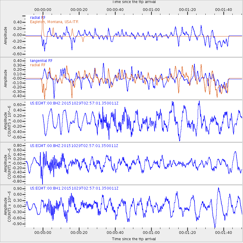
EGMT Eagleton, Montana, USA - Earthquake Result Viewer
*The percent match for this event was below the threshold and hence no stack was calculated.
| Earthquake location: |
Rat Islands, Aleutian Islands |
| Earthquake latitude/longitude: |
51.8/178.5 |
| Earthquake time(UTC): |
2015/10/29 (302) 02:49:28 GMT |
| Earthquake Depth: |
88 km |
| Earthquake Magnitude: |
5.6 MB |
| Earthquake Catalog/Contributor: |
NEIC PDE/NEIC COMCAT |
|
| Network: |
US United States National Seismic Network |
| Station: |
EGMT Eagleton, Montana, USA |
| Lat/Lon: |
48.02 N/109.75 W |
| Elevation: |
1055 m |
|
| Distance: |
44.6 deg |
| Az: |
65.16 deg |
| Baz: |
302.952 deg |
| Ray Param: |
$rayparam |
*The percent match for this event was below the threshold and hence was not used in the summary stack. |
|
| Radial Match: |
51.895626 % |
| Radial Bump: |
400 |
| Transverse Match: |
53.110863 % |
| Transverse Bump: |
400 |
| SOD ConfigId: |
1259291 |
| Insert Time: |
2015-11-12 03:03:52.615 +0000 |
| GWidth: |
2.5 |
| Max Bumps: |
400 |
| Tol: |
0.001 |
|
Signal To Noise
| Channel | StoN | STA | LTA |
| US:EGMT:00:BHZ:20151029T02:57:01.350011Z | 2.7142959 | 3.3759153E-7 | 1.2437538E-7 |
| US:EGMT:00:BH1:20151029T02:57:01.350011Z | 0.97110456 | 2.136778E-7 | 2.2003582E-7 |
| US:EGMT:00:BH2:20151029T02:57:01.350011Z | 0.7599067 | 2.0055151E-7 | 2.6391595E-7 |
| Arrivals |
| Ps | |
| PpPs | |
| PsPs/PpSs | |


