You are here: Home > Network List > TA - USArray Transportable Network (new EarthScope stations) Stations List
> Station ABTX Abilene, Hawley, TX, USA > Earthquake Result Viewer
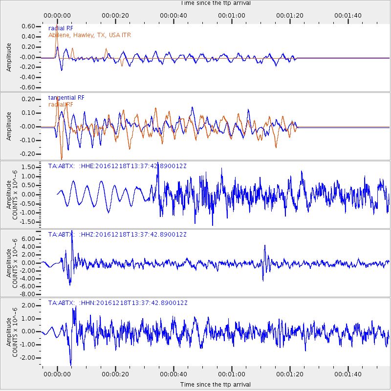
ABTX Abilene, Hawley, TX, USA - Earthquake Result Viewer
*The percent match for this event was below the threshold and hence no stack was calculated.
| Earthquake location: |
Peru-Brazil Border Region |
| Earthquake latitude/longitude: |
-10.0/-71.0 |
| Earthquake time(UTC): |
2016/12/18 (353) 13:30:11 GMT |
| Earthquake Depth: |
619 km |
| Earthquake Magnitude: |
6.4 Mww |
| Earthquake Catalog/Contributor: |
NEIC PDE/us |
|
| Network: |
TA USArray Transportable Network (new EarthScope stations) |
| Station: |
ABTX Abilene, Hawley, TX, USA |
| Lat/Lon: |
32.62 N/99.64 W |
| Elevation: |
502 m |
|
| Distance: |
50.4 deg |
| Az: |
328.309 deg |
| Baz: |
142.175 deg |
| Ray Param: |
$rayparam |
*The percent match for this event was below the threshold and hence was not used in the summary stack. |
|
| Radial Match: |
47.08398 % |
| Radial Bump: |
292 |
| Transverse Match: |
51.936802 % |
| Transverse Bump: |
336 |
| SOD ConfigId: |
11737051 |
| Insert Time: |
2019-04-26 09:11:54.271 +0000 |
| GWidth: |
2.5 |
| Max Bumps: |
400 |
| Tol: |
0.001 |
|
Signal To Noise
| Channel | StoN | STA | LTA |
| TA:ABTX: :HHZ:20161218T13:37:42.890012Z | 6.106236 | 2.0318903E-6 | 3.327566E-7 |
| TA:ABTX: :HHN:20161218T13:37:42.890012Z | 4.7811856 | 7.8094916E-7 | 1.6333796E-7 |
| TA:ABTX: :HHE:20161218T13:37:42.890012Z | 1.2866997 | 5.4080715E-7 | 4.203057E-7 |
| Arrivals |
| Ps | |
| PpPs | |
| PsPs/PpSs | |


