You are here: Home > Network List > CI - Caltech Regional Seismic Network Stations List
> Station BEL Belle Mtn, Joshua Tree National Park, CA, USA > Earthquake Result Viewer
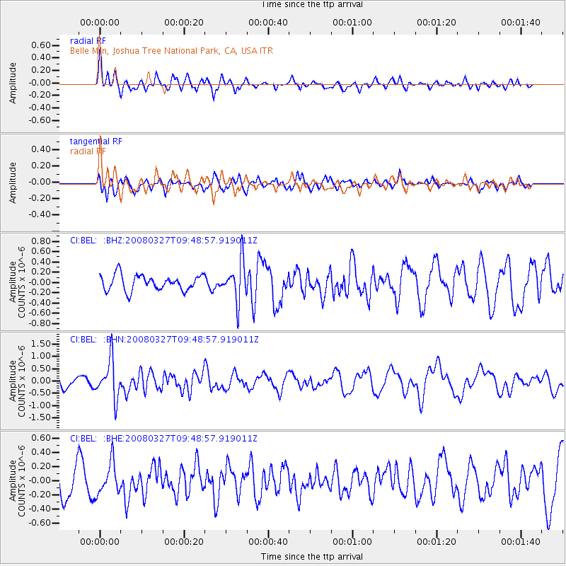
BEL Belle Mtn, Joshua Tree National Park, CA, USA - Earthquake Result Viewer
*The percent match for this event was below the threshold and hence no stack was calculated.
| Earthquake location: |
North Of Honduras |
| Earthquake latitude/longitude: |
17.2/-84.8 |
| Earthquake time(UTC): |
2008/03/27 (087) 09:42:57 GMT |
| Earthquake Depth: |
10 km |
| Earthquake Magnitude: |
5.6 MW, 5.1 MS, 5.4 MB, 5.6 MW |
| Earthquake Catalog/Contributor: |
WHDF/NEIC |
|
| Network: |
CI Caltech Regional Seismic Network |
| Station: |
BEL Belle Mtn, Joshua Tree National Park, CA, USA |
| Lat/Lon: |
34.00 N/116.00 W |
| Elevation: |
1388 m |
|
| Distance: |
32.5 deg |
| Az: |
306.929 deg |
| Baz: |
113.114 deg |
| Ray Param: |
$rayparam |
*The percent match for this event was below the threshold and hence was not used in the summary stack. |
|
| Radial Match: |
65.347206 % |
| Radial Bump: |
400 |
| Transverse Match: |
59.214798 % |
| Transverse Bump: |
400 |
| SOD ConfigId: |
2504 |
| Insert Time: |
2010-03-05 20:44:45.533 +0000 |
| GWidth: |
2.5 |
| Max Bumps: |
400 |
| Tol: |
0.001 |
|
Signal To Noise
| Channel | StoN | STA | LTA |
| CI:BEL: :BHN:20080327T09:48:57.919011Z | 3.1470516 | 8.0224464E-7 | 2.5491946E-7 |
| CI:BEL: :BHE:20080327T09:48:57.919011Z | 0.9195088 | 2.2283682E-7 | 2.4234333E-7 |
| CI:BEL: :BHZ:20080327T09:48:57.919011Z | 2.6768134 | 3.9718702E-7 | 1.4838054E-7 |
| Arrivals |
| Ps | |
| PpPs | |
| PsPs/PpSs | |


