You are here: Home > Network List > TA - USArray Transportable Network (new EarthScope stations) Stations List
> Station BGNE Belgrade, NE, USA > Earthquake Result Viewer
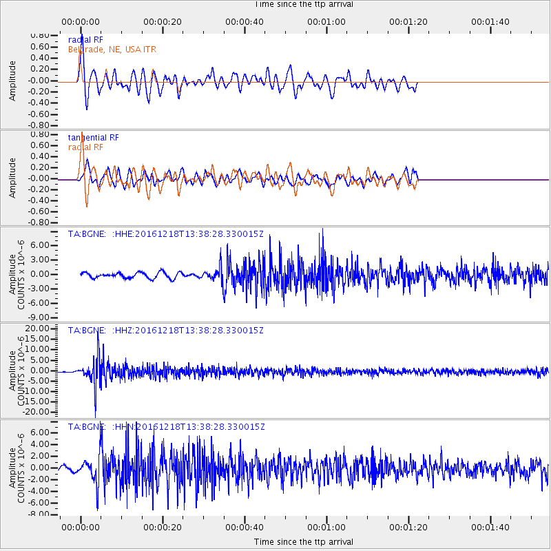
BGNE Belgrade, NE, USA - Earthquake Result Viewer
*The percent match for this event was below the threshold and hence no stack was calculated.
| Earthquake location: |
Peru-Brazil Border Region |
| Earthquake latitude/longitude: |
-10.0/-71.0 |
| Earthquake time(UTC): |
2016/12/18 (353) 13:30:11 GMT |
| Earthquake Depth: |
619 km |
| Earthquake Magnitude: |
6.4 Mww |
| Earthquake Catalog/Contributor: |
NEIC PDE/us |
|
| Network: |
TA USArray Transportable Network (new EarthScope stations) |
| Station: |
BGNE Belgrade, NE, USA |
| Lat/Lon: |
41.41 N/98.15 W |
| Elevation: |
573 m |
|
| Distance: |
56.9 deg |
| Az: |
335.787 deg |
| Baz: |
147.513 deg |
| Ray Param: |
$rayparam |
*The percent match for this event was below the threshold and hence was not used in the summary stack. |
|
| Radial Match: |
77.212135 % |
| Radial Bump: |
374 |
| Transverse Match: |
66.73707 % |
| Transverse Bump: |
400 |
| SOD ConfigId: |
11737051 |
| Insert Time: |
2019-04-26 09:11:58.075 +0000 |
| GWidth: |
2.5 |
| Max Bumps: |
400 |
| Tol: |
0.001 |
|
Signal To Noise
| Channel | StoN | STA | LTA |
| TA:BGNE: :HHZ:20161218T13:38:28.330015Z | 19.2754 | 6.5824242E-6 | 3.4149355E-7 |
| TA:BGNE: :HHN:20161218T13:38:28.330015Z | 2.8532631 | 2.2422614E-6 | 7.858586E-7 |
| TA:BGNE: :HHE:20161218T13:38:28.330015Z | 2.3471036 | 1.4136781E-6 | 6.023075E-7 |
| Arrivals |
| Ps | |
| PpPs | |
| PsPs/PpSs | |


