You are here: Home > Network List > TA - USArray Transportable Network (new EarthScope stations) Stations List
> Station D25K Kavik River, AK, USA > Earthquake Result Viewer
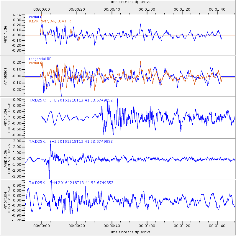
D25K Kavik River, AK, USA - Earthquake Result Viewer
*The percent match for this event was below the threshold and hence no stack was calculated.
| Earthquake location: |
Peru-Brazil Border Region |
| Earthquake latitude/longitude: |
-10.0/-71.0 |
| Earthquake time(UTC): |
2016/12/18 (353) 13:30:11 GMT |
| Earthquake Depth: |
619 km |
| Earthquake Magnitude: |
6.4 Mww |
| Earthquake Catalog/Contributor: |
NEIC PDE/us |
|
| Network: |
TA USArray Transportable Network (new EarthScope stations) |
| Station: |
D25K Kavik River, AK, USA |
| Lat/Lon: |
69.32 N/146.38 W |
| Elevation: |
770 m |
|
| Distance: |
94.2 deg |
| Az: |
339.839 deg |
| Baz: |
107.088 deg |
| Ray Param: |
$rayparam |
*The percent match for this event was below the threshold and hence was not used in the summary stack. |
|
| Radial Match: |
48.397648 % |
| Radial Bump: |
400 |
| Transverse Match: |
50.272087 % |
| Transverse Bump: |
400 |
| SOD ConfigId: |
11737051 |
| Insert Time: |
2019-04-26 09:12:02.250 +0000 |
| GWidth: |
2.5 |
| Max Bumps: |
400 |
| Tol: |
0.001 |
|
Signal To Noise
| Channel | StoN | STA | LTA |
| TA:D25K: :BHZ:20161218T13:41:53.674985Z | 3.2592072 | 9.288561E-7 | 2.8499448E-7 |
| TA:D25K: :BHN:20161218T13:41:53.674985Z | 0.8409825 | 2.737665E-7 | 3.2553172E-7 |
| TA:D25K: :BHE:20161218T13:41:53.674985Z | 1.4581393 | 2.1445854E-7 | 1.4707685E-7 |
| Arrivals |
| Ps | |
| PpPs | |
| PsPs/PpSs | |


