You are here: Home > Network List > CI - Caltech Regional Seismic Network Stations List
> Station BEL Belle Mtn, Joshua Tree National Park, CA, USA > Earthquake Result Viewer
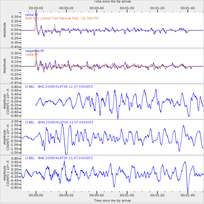
BEL Belle Mtn, Joshua Tree National Park, CA, USA - Earthquake Result Viewer
*The percent match for this event was below the threshold and hence no stack was calculated.
| Earthquake location: |
Loyalty Islands |
| Earthquake latitude/longitude: |
-20.3/168.8 |
| Earthquake time(UTC): |
2008/04/19 (110) 05:58:42 GMT |
| Earthquake Depth: |
14 km |
| Earthquake Magnitude: |
5.7 MB, 6.2 MS, 6.3 MW, 6.2 MW |
| Earthquake Catalog/Contributor: |
WHDF/NEIC |
|
| Network: |
CI Caltech Regional Seismic Network |
| Station: |
BEL Belle Mtn, Joshua Tree National Park, CA, USA |
| Lat/Lon: |
34.00 N/116.00 W |
| Elevation: |
1388 m |
|
| Distance: |
89.6 deg |
| Az: |
53.441 deg |
| Baz: |
245.19 deg |
| Ray Param: |
$rayparam |
*The percent match for this event was below the threshold and hence was not used in the summary stack. |
|
| Radial Match: |
57.623333 % |
| Radial Bump: |
320 |
| Transverse Match: |
48.92163 % |
| Transverse Bump: |
369 |
| SOD ConfigId: |
2504 |
| Insert Time: |
2010-03-05 20:44:52.510 +0000 |
| GWidth: |
2.5 |
| Max Bumps: |
400 |
| Tol: |
0.001 |
|
Signal To Noise
| Channel | StoN | STA | LTA |
| CI:BEL: :BHN:20080419T06:11:07.643005Z | 4.794823 | 4.5944017E-7 | 9.582004E-8 |
| CI:BEL: :BHE:20080419T06:11:07.643005Z | 0.5778693 | 9.971466E-8 | 1.7255574E-7 |
| CI:BEL: :BHZ:20080419T06:11:07.643005Z | 1.5571307 | 2.096617E-7 | 1.3464619E-7 |
| Arrivals |
| Ps | |
| PpPs | |
| PsPs/PpSs | |


