You are here: Home > Network List > TA - USArray Transportable Network (new EarthScope stations) Stations List
> Station TUL1 Leonard, OK, USA > Earthquake Result Viewer
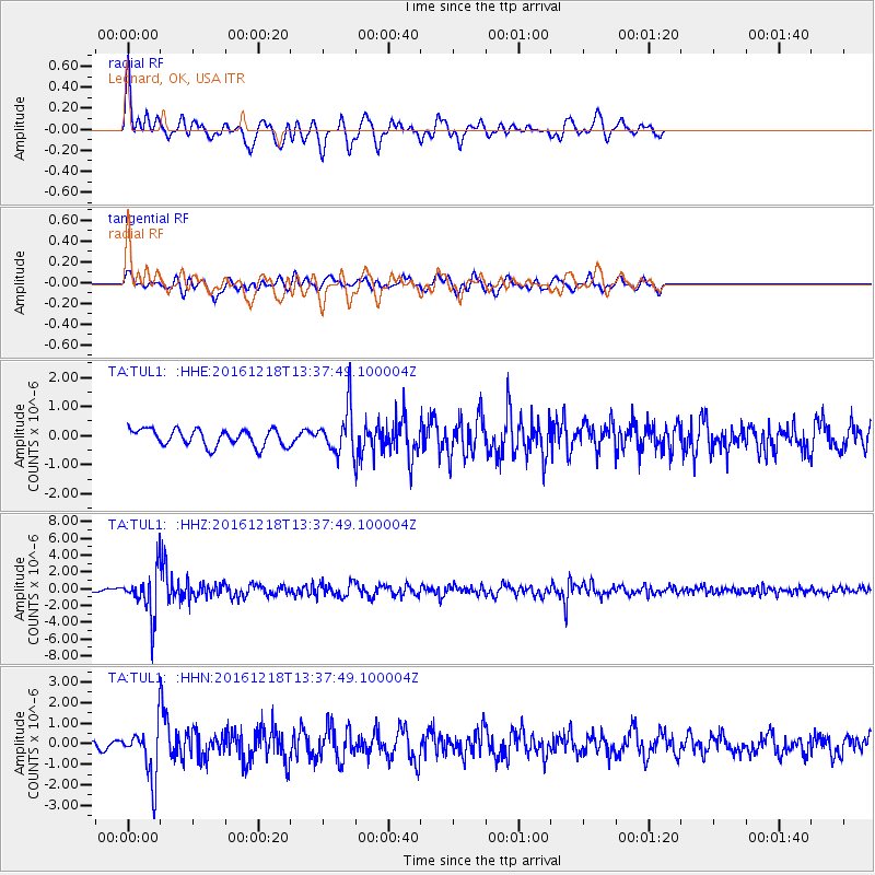
TUL1 Leonard, OK, USA - Earthquake Result Viewer
*The percent match for this event was below the threshold and hence no stack was calculated.
| Earthquake location: |
Peru-Brazil Border Region |
| Earthquake latitude/longitude: |
-10.0/-71.0 |
| Earthquake time(UTC): |
2016/12/18 (353) 13:30:11 GMT |
| Earthquake Depth: |
619 km |
| Earthquake Magnitude: |
6.4 Mww |
| Earthquake Catalog/Contributor: |
NEIC PDE/us |
|
| Network: |
TA USArray Transportable Network (new EarthScope stations) |
| Station: |
TUL1 Leonard, OK, USA |
| Lat/Lon: |
35.91 N/95.79 W |
| Elevation: |
256 m |
|
| Distance: |
51.3 deg |
| Az: |
334.1 deg |
| Baz: |
147.992 deg |
| Ray Param: |
$rayparam |
*The percent match for this event was below the threshold and hence was not used in the summary stack. |
|
| Radial Match: |
77.305954 % |
| Radial Bump: |
400 |
| Transverse Match: |
54.42034 % |
| Transverse Bump: |
400 |
| SOD ConfigId: |
11737051 |
| Insert Time: |
2019-04-26 09:12:58.768 +0000 |
| GWidth: |
2.5 |
| Max Bumps: |
400 |
| Tol: |
0.001 |
|
Signal To Noise
| Channel | StoN | STA | LTA |
| TA:TUL1: :HHZ:20161218T13:37:49.100004Z | 12.125226 | 2.5832646E-6 | 2.1304876E-7 |
| TA:TUL1: :HHN:20161218T13:37:49.100004Z | 3.2703466 | 1.203327E-6 | 3.679509E-7 |
| TA:TUL1: :HHE:20161218T13:37:49.100004Z | 2.7068024 | 7.802593E-7 | 2.882587E-7 |
| Arrivals |
| Ps | |
| PpPs | |
| PsPs/PpSs | |


