You are here: Home > Network List > TA - USArray Transportable Network (new EarthScope stations) Stations List
> Station WHTX Lake Whitney, Meridian, TX, USA > Earthquake Result Viewer
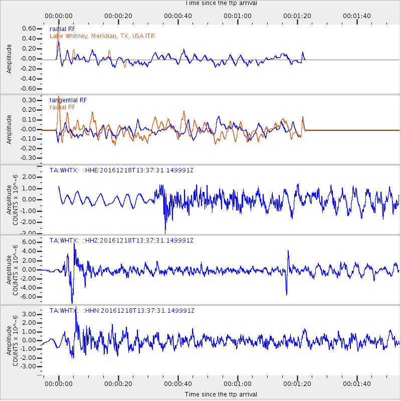
WHTX Lake Whitney, Meridian, TX, USA - Earthquake Result Viewer
*The percent match for this event was below the threshold and hence no stack was calculated.
| Earthquake location: |
Peru-Brazil Border Region |
| Earthquake latitude/longitude: |
-10.0/-71.0 |
| Earthquake time(UTC): |
2016/12/18 (353) 13:30:11 GMT |
| Earthquake Depth: |
619 km |
| Earthquake Magnitude: |
6.4 Mww |
| Earthquake Catalog/Contributor: |
NEIC PDE/us |
|
| Network: |
TA USArray Transportable Network (new EarthScope stations) |
| Station: |
WHTX Lake Whitney, Meridian, TX, USA |
| Lat/Lon: |
31.99 N/97.46 W |
| Elevation: |
190 m |
|
| Distance: |
48.8 deg |
| Az: |
329.761 deg |
| Baz: |
144.279 deg |
| Ray Param: |
$rayparam |
*The percent match for this event was below the threshold and hence was not used in the summary stack. |
|
| Radial Match: |
66.05137 % |
| Radial Bump: |
400 |
| Transverse Match: |
37.029957 % |
| Transverse Bump: |
400 |
| SOD ConfigId: |
11737051 |
| Insert Time: |
2019-04-26 09:13:00.532 +0000 |
| GWidth: |
2.5 |
| Max Bumps: |
400 |
| Tol: |
0.001 |
|
Signal To Noise
| Channel | StoN | STA | LTA |
| TA:WHTX: :HHZ:20161218T13:37:31.149991Z | 4.3162117 | 2.390384E-6 | 5.5381525E-7 |
| TA:WHTX: :HHN:20161218T13:37:31.149991Z | 1.6102093 | 7.7116255E-7 | 4.789207E-7 |
| TA:WHTX: :HHE:20161218T13:37:31.149991Z | 1.273455 | 4.7415068E-7 | 3.7233409E-7 |
| Arrivals |
| Ps | |
| PpPs | |
| PsPs/PpSs | |


