You are here: Home > Network List > CI - Caltech Regional Seismic Network Stations List
> Station BAR Barrett, Tecate, CA, USA > Earthquake Result Viewer
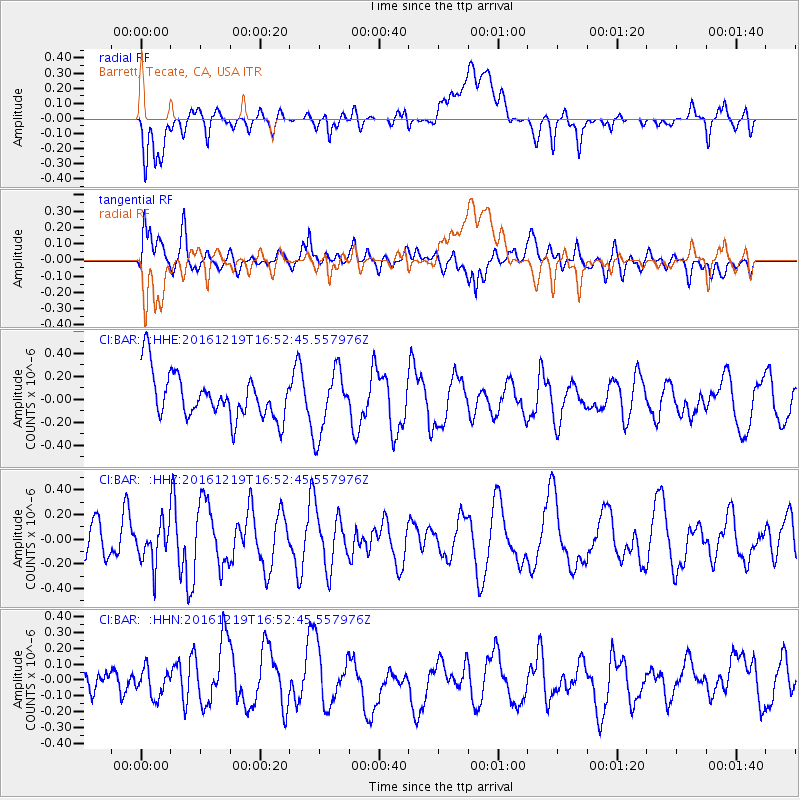
BAR Barrett, Tecate, CA, USA - Earthquake Result Viewer
*The percent match for this event was below the threshold and hence no stack was calculated.
| Earthquake location: |
Near East Coast Of Honshu, Japan |
| Earthquake latitude/longitude: |
37.5/141.5 |
| Earthquake time(UTC): |
2016/12/19 (354) 16:41:14 GMT |
| Earthquake Depth: |
27 km |
| Earthquake Magnitude: |
5.5 mb |
| Earthquake Catalog/Contributor: |
NEIC PDE/us |
|
| Network: |
CI Caltech Regional Seismic Network |
| Station: |
BAR Barrett, Tecate, CA, USA |
| Lat/Lon: |
32.68 N/116.67 W |
| Elevation: |
521 m |
|
| Distance: |
79.2 deg |
| Az: |
57.178 deg |
| Baz: |
307.534 deg |
| Ray Param: |
$rayparam |
*The percent match for this event was below the threshold and hence was not used in the summary stack. |
|
| Radial Match: |
39.674484 % |
| Radial Bump: |
400 |
| Transverse Match: |
56.11132 % |
| Transverse Bump: |
400 |
| SOD ConfigId: |
11737051 |
| Insert Time: |
2019-04-26 09:18:00.101 +0000 |
| GWidth: |
2.5 |
| Max Bumps: |
400 |
| Tol: |
0.001 |
|
Signal To Noise
| Channel | StoN | STA | LTA |
| CI:BAR: :HHZ:20161219T16:52:45.557976Z | 0.98455215 | 1.6551083E-7 | 1.6810773E-7 |
| CI:BAR: :HHN:20161219T16:52:45.557976Z | 0.56255966 | 9.125654E-8 | 1.6221664E-7 |
| CI:BAR: :HHE:20161219T16:52:45.557976Z | 1.4097192 | 2.7681176E-7 | 1.9635951E-7 |
| Arrivals |
| Ps | |
| PpPs | |
| PsPs/PpSs | |


