You are here: Home > Network List > CI - Caltech Regional Seismic Network Stations List
> Station BEL Belle Mtn, Joshua Tree National Park, CA, USA > Earthquake Result Viewer
BEL Belle Mtn, Joshua Tree National Park, CA, USA - Earthquake Result Viewer
*The percent match for this event was below the threshold and hence no stack was calculated.
| Earthquake location: |
Fiji Islands Region |
| Earthquake latitude/longitude: |
-17.6/-178.6 |
| Earthquake time(UTC): |
2004/07/15 (197) 04:27:12 GMT |
| Earthquake Depth: |
560 km |
| Earthquake Magnitude: |
5.5 MB |
| Earthquake Catalog/Contributor: |
WHDF/NEIC |
|
| Network: |
CI Caltech Regional Seismic Network |
| Station: |
BEL Belle Mtn, Joshua Tree National Park, CA, USA |
| Lat/Lon: |
34.00 N/116.00 W |
| Elevation: |
1388 m |
|
| Distance: |
78.7 deg |
| Az: |
48.799 deg |
| Baz: |
239.725 deg |
| Ray Param: |
$rayparam |
*The percent match for this event was below the threshold and hence was not used in the summary stack. |
|
| Radial Match: |
94.4882 % |
| Radial Bump: |
392 |
| Transverse Match: |
91.594086 % |
| Transverse Bump: |
400 |
| SOD ConfigId: |
2459 |
| Insert Time: |
2010-03-05 20:45:38.141 +0000 |
| GWidth: |
2.5 |
| Max Bumps: |
400 |
| Tol: |
0.001 |
|
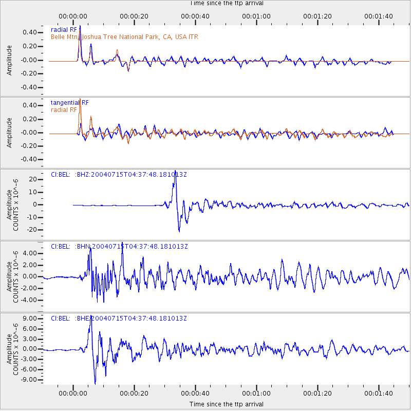
Signal To Noise
| Channel | StoN | STA | LTA |
| CI:BEL: :BHN:20040715T04:37:48.181013Z | 5.4402947 | 6.508621E-7 | 1.1963729E-7 |
| CI:BEL: :BHE:20040715T04:37:48.181013Z | 7.563014 | 7.2888344E-7 | 9.637473E-8 |
| CI:BEL: :BHZ:20040715T04:37:48.181013Z | 27.339916 | 2.922938E-6 | 1.0691101E-7 |
| Arrivals |
| Ps | |
| PpPs | |
| PsPs/PpSs | |


