You are here: Home > Network List > TA - USArray Transportable Network (new EarthScope stations) Stations List
> Station MDND Maddock, ND, USA > Earthquake Result Viewer
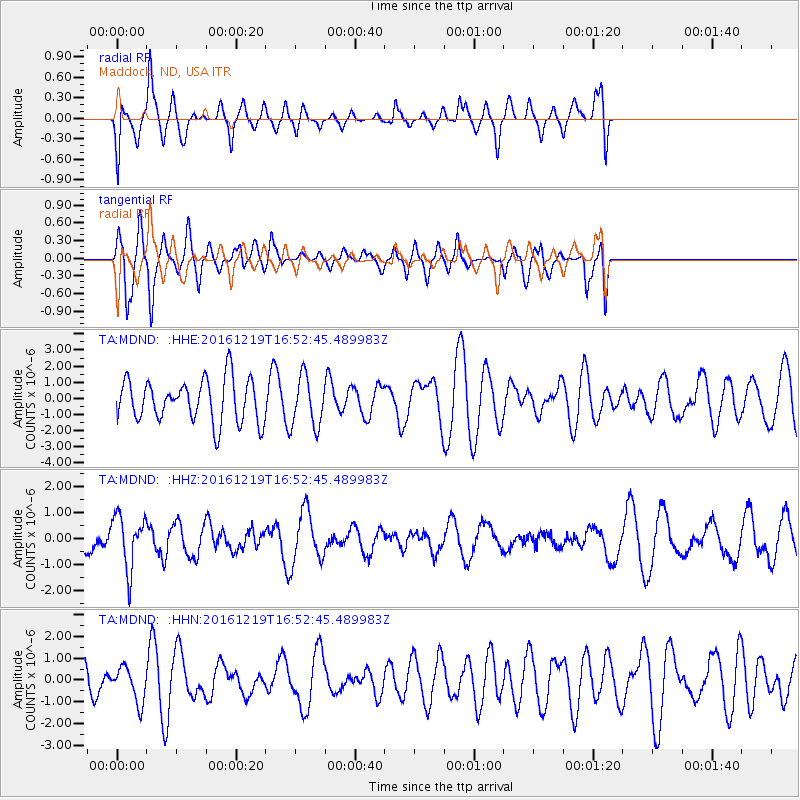
MDND Maddock, ND, USA - Earthquake Result Viewer
*The percent match for this event was below the threshold and hence no stack was calculated.
| Earthquake location: |
Near East Coast Of Honshu, Japan |
| Earthquake latitude/longitude: |
37.5/141.5 |
| Earthquake time(UTC): |
2016/12/19 (354) 16:41:14 GMT |
| Earthquake Depth: |
27 km |
| Earthquake Magnitude: |
5.5 mb |
| Earthquake Catalog/Contributor: |
NEIC PDE/us |
|
| Network: |
TA USArray Transportable Network (new EarthScope stations) |
| Station: |
MDND Maddock, ND, USA |
| Lat/Lon: |
47.85 N/99.60 W |
| Elevation: |
479 m |
|
| Distance: |
79.1 deg |
| Az: |
36.9 deg |
| Baz: |
314.816 deg |
| Ray Param: |
$rayparam |
*The percent match for this event was below the threshold and hence was not used in the summary stack. |
|
| Radial Match: |
51.059315 % |
| Radial Bump: |
400 |
| Transverse Match: |
73.92136 % |
| Transverse Bump: |
400 |
| SOD ConfigId: |
11737051 |
| Insert Time: |
2019-04-26 09:23:20.835 +0000 |
| GWidth: |
2.5 |
| Max Bumps: |
400 |
| Tol: |
0.001 |
|
Signal To Noise
| Channel | StoN | STA | LTA |
| TA:MDND: :HHZ:20161219T16:52:45.489983Z | 1.7910401 | 1.0268274E-6 | 5.7331346E-7 |
| TA:MDND: :HHN:20161219T16:52:45.489983Z | 0.7503465 | 8.095042E-7 | 1.0788405E-6 |
| TA:MDND: :HHE:20161219T16:52:45.489983Z | 1.2325363 | 1.6258335E-6 | 1.3190959E-6 |
| Arrivals |
| Ps | |
| PpPs | |
| PsPs/PpSs | |


