You are here: Home > Network List > CI - Caltech Regional Seismic Network Stations List
> Station BEL Belle Mtn, Joshua Tree National Park, CA, USA > Earthquake Result Viewer
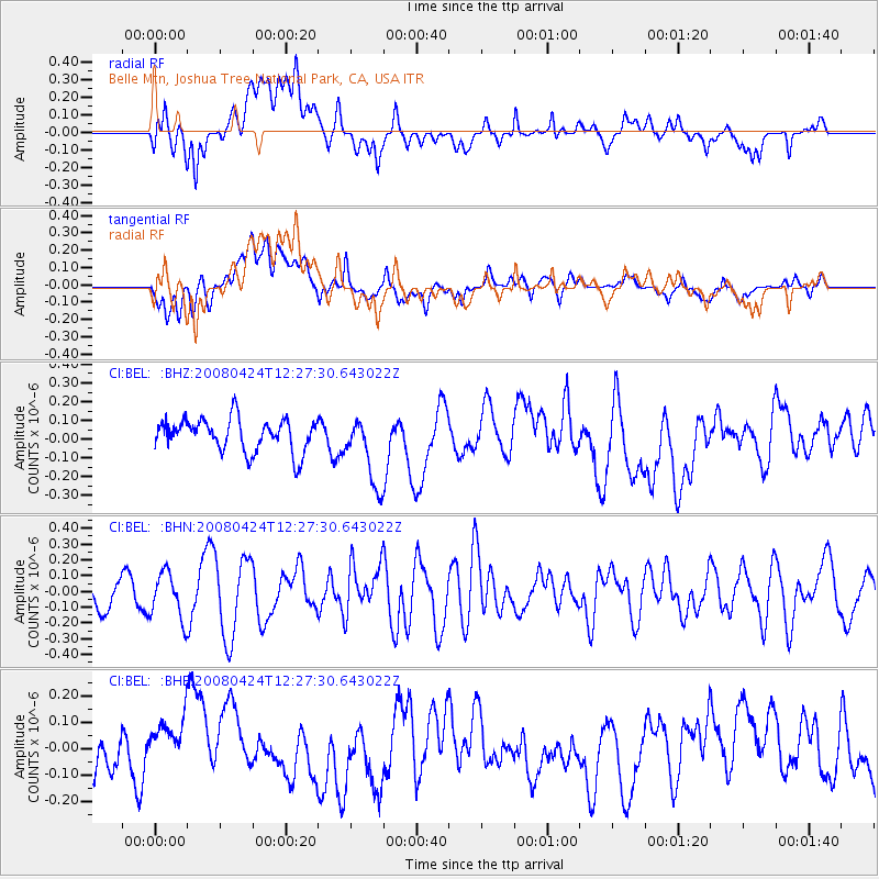
BEL Belle Mtn, Joshua Tree National Park, CA, USA - Earthquake Result Viewer
*The percent match for this event was below the threshold and hence no stack was calculated.
| Earthquake location: |
Central Mid-Atlantic Ridge |
| Earthquake latitude/longitude: |
-1.2/-23.5 |
| Earthquake time(UTC): |
2008/04/24 (115) 12:14:49 GMT |
| Earthquake Depth: |
10 km |
| Earthquake Magnitude: |
6.0 MS, 5.4 MB, 6.5 MW, 6.4 MW |
| Earthquake Catalog/Contributor: |
WHDF/NEIC |
|
| Network: |
CI Caltech Regional Seismic Network |
| Station: |
BEL Belle Mtn, Joshua Tree National Park, CA, USA |
| Lat/Lon: |
34.00 N/116.00 W |
| Elevation: |
1388 m |
|
| Distance: |
92.8 deg |
| Az: |
303.807 deg |
| Baz: |
89.569 deg |
| Ray Param: |
$rayparam |
*The percent match for this event was below the threshold and hence was not used in the summary stack. |
|
| Radial Match: |
60.412415 % |
| Radial Bump: |
400 |
| Transverse Match: |
47.501736 % |
| Transverse Bump: |
400 |
| SOD ConfigId: |
2504 |
| Insert Time: |
2010-03-05 20:46:05.501 +0000 |
| GWidth: |
2.5 |
| Max Bumps: |
400 |
| Tol: |
0.001 |
|
Signal To Noise
| Channel | StoN | STA | LTA |
| CI:BEL: :BHN:20080424T12:27:30.643022Z | 1.1219604 | 1.4614999E-7 | 1.3026306E-7 |
| CI:BEL: :BHE:20080424T12:27:30.643022Z | 1.6151072 | 1.1930041E-7 | 7.386532E-8 |
| CI:BEL: :BHZ:20080424T12:27:30.643022Z | 2.169879 | 1.8737921E-7 | 8.635468E-8 |
| Arrivals |
| Ps | |
| PpPs | |
| PsPs/PpSs | |


