You are here: Home > Network List > CI - Caltech Regional Seismic Network Stations List
> Station MPP McPhearson Peak > Earthquake Result Viewer
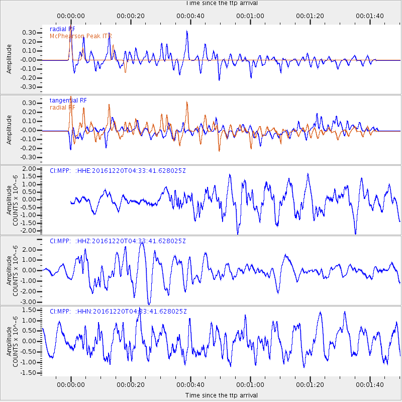
MPP McPhearson Peak - Earthquake Result Viewer
*The percent match for this event was below the threshold and hence no stack was calculated.
| Earthquake location: |
Solomon Islands |
| Earthquake latitude/longitude: |
-10.2/161.2 |
| Earthquake time(UTC): |
2016/12/20 (355) 04:21:28 GMT |
| Earthquake Depth: |
11 km |
| Earthquake Magnitude: |
6.4 mww |
| Earthquake Catalog/Contributor: |
NEIC PDE/us |
|
| Network: |
CI Caltech Regional Seismic Network |
| Station: |
MPP McPhearson Peak |
| Lat/Lon: |
34.89 N/119.81 W |
| Elevation: |
1739 m |
|
| Distance: |
86.9 deg |
| Az: |
53.908 deg |
| Baz: |
255.368 deg |
| Ray Param: |
$rayparam |
*The percent match for this event was below the threshold and hence was not used in the summary stack. |
|
| Radial Match: |
76.84518 % |
| Radial Bump: |
400 |
| Transverse Match: |
49.707638 % |
| Transverse Bump: |
400 |
| SOD ConfigId: |
11737051 |
| Insert Time: |
2019-04-26 09:34:09.242 +0000 |
| GWidth: |
2.5 |
| Max Bumps: |
400 |
| Tol: |
0.001 |
|
Signal To Noise
| Channel | StoN | STA | LTA |
| CI:MPP: :HHZ:20161220T04:33:41.628025Z | 5.0666475 | 1.0132889E-6 | 1.9999197E-7 |
| CI:MPP: :HHN:20161220T04:33:41.628025Z | 0.74284035 | 3.1064243E-7 | 4.1818194E-7 |
| CI:MPP: :HHE:20161220T04:33:41.628025Z | 1.5618627 | 5.021255E-7 | 3.2149146E-7 |
| Arrivals |
| Ps | |
| PpPs | |
| PsPs/PpSs | |


