You are here: Home > Network List > TA - USArray Transportable Network (new EarthScope stations) Stations List
> Station G21K Allakaket, AK, USA > Earthquake Result Viewer
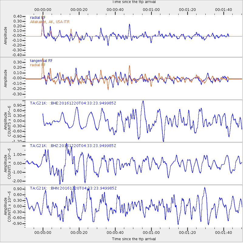
G21K Allakaket, AK, USA - Earthquake Result Viewer
*The percent match for this event was below the threshold and hence no stack was calculated.
| Earthquake location: |
Solomon Islands |
| Earthquake latitude/longitude: |
-10.2/161.2 |
| Earthquake time(UTC): |
2016/12/20 (355) 04:21:28 GMT |
| Earthquake Depth: |
11 km |
| Earthquake Magnitude: |
6.4 mww |
| Earthquake Catalog/Contributor: |
NEIC PDE/us |
|
| Network: |
TA USArray Transportable Network (new EarthScope stations) |
| Station: |
G21K Allakaket, AK, USA |
| Lat/Lon: |
66.52 N/153.51 W |
| Elevation: |
446 m |
|
| Distance: |
83.3 deg |
| Az: |
16.659 deg |
| Baz: |
224.758 deg |
| Ray Param: |
$rayparam |
*The percent match for this event was below the threshold and hence was not used in the summary stack. |
|
| Radial Match: |
64.61681 % |
| Radial Bump: |
400 |
| Transverse Match: |
52.71042 % |
| Transverse Bump: |
400 |
| SOD ConfigId: |
11737051 |
| Insert Time: |
2019-04-26 09:37:24.683 +0000 |
| GWidth: |
2.5 |
| Max Bumps: |
400 |
| Tol: |
0.001 |
|
Signal To Noise
| Channel | StoN | STA | LTA |
| TA:G21K: :BHZ:20161220T04:33:23.949985Z | 3.3308094 | 9.1702293E-7 | 2.7531533E-7 |
| TA:G21K: :BHN:20161220T04:33:23.949985Z | 1.9776647 | 4.2800858E-7 | 2.164212E-7 |
| TA:G21K: :BHE:20161220T04:33:23.949985Z | 1.482667 | 4.402658E-7 | 2.969418E-7 |
| Arrivals |
| Ps | |
| PpPs | |
| PsPs/PpSs | |


