You are here: Home > Network List > TA - USArray Transportable Network (new EarthScope stations) Stations List
> Station P17K Kvichak River, AK, USA > Earthquake Result Viewer
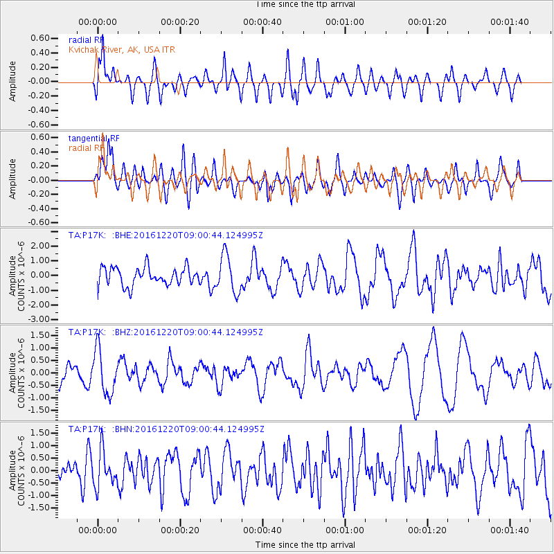
P17K Kvichak River, AK, USA - Earthquake Result Viewer
*The percent match for this event was below the threshold and hence no stack was calculated.
| Earthquake location: |
Solomon Islands |
| Earthquake latitude/longitude: |
-10.2/161.0 |
| Earthquake time(UTC): |
2016/12/20 (355) 08:49:25 GMT |
| Earthquake Depth: |
38 km |
| Earthquake Magnitude: |
5.5 mb |
| Earthquake Catalog/Contributor: |
NEIC PDE/us |
|
| Network: |
TA USArray Transportable Network (new EarthScope stations) |
| Station: |
P17K Kvichak River, AK, USA |
| Lat/Lon: |
59.20 N/156.44 W |
| Elevation: |
91 m |
|
| Distance: |
77.1 deg |
| Az: |
20.921 deg |
| Baz: |
223.08 deg |
| Ray Param: |
$rayparam |
*The percent match for this event was below the threshold and hence was not used in the summary stack. |
|
| Radial Match: |
51.71913 % |
| Radial Bump: |
400 |
| Transverse Match: |
57.976585 % |
| Transverse Bump: |
400 |
| SOD ConfigId: |
11737051 |
| Insert Time: |
2019-04-26 09:44:50.213 +0000 |
| GWidth: |
2.5 |
| Max Bumps: |
400 |
| Tol: |
0.001 |
|
Signal To Noise
| Channel | StoN | STA | LTA |
| TA:P17K: :BHZ:20161220T09:00:44.124995Z | 1.8422803 | 9.102659E-7 | 4.9409743E-7 |
| TA:P17K: :BHN:20161220T09:00:44.124995Z | 1.2263129 | 7.295659E-7 | 5.949264E-7 |
| TA:P17K: :BHE:20161220T09:00:44.124995Z | 2.1899834 | 1.3166836E-6 | 6.0122994E-7 |
| Arrivals |
| Ps | |
| PpPs | |
| PsPs/PpSs | |


