You are here: Home > Network List > TA - USArray Transportable Network (new EarthScope stations) Stations List
> Station R11A Troy Canyon, Currant, NV, USA > Earthquake Result Viewer
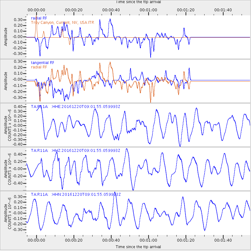
R11A Troy Canyon, Currant, NV, USA - Earthquake Result Viewer
*The percent match for this event was below the threshold and hence no stack was calculated.
| Earthquake location: |
Solomon Islands |
| Earthquake latitude/longitude: |
-10.2/161.0 |
| Earthquake time(UTC): |
2016/12/20 (355) 08:49:25 GMT |
| Earthquake Depth: |
38 km |
| Earthquake Magnitude: |
5.5 mb |
| Earthquake Catalog/Contributor: |
NEIC PDE/us |
|
| Network: |
TA USArray Transportable Network (new EarthScope stations) |
| Station: |
R11A Troy Canyon, Currant, NV, USA |
| Lat/Lon: |
38.35 N/115.59 W |
| Elevation: |
1756 m |
|
| Distance: |
91.1 deg |
| Az: |
51.375 deg |
| Baz: |
257.998 deg |
| Ray Param: |
$rayparam |
*The percent match for this event was below the threshold and hence was not used in the summary stack. |
|
| Radial Match: |
70.19152 % |
| Radial Bump: |
400 |
| Transverse Match: |
51.732372 % |
| Transverse Bump: |
400 |
| SOD ConfigId: |
11737051 |
| Insert Time: |
2019-04-26 09:44:54.658 +0000 |
| GWidth: |
2.5 |
| Max Bumps: |
400 |
| Tol: |
0.001 |
|
Signal To Noise
| Channel | StoN | STA | LTA |
| TA:R11A: :HHZ:20161220T09:01:55.059993Z | 1.6492034 | 1.5088766E-7 | 9.149124E-8 |
| TA:R11A: :HHN:20161220T09:01:55.059993Z | 1.4820045 | 2.8665133E-7 | 1.9342136E-7 |
| TA:R11A: :HHE:20161220T09:01:55.059993Z | 1.3007493 | 2.2316327E-7 | 1.7156516E-7 |
| Arrivals |
| Ps | |
| PpPs | |
| PsPs/PpSs | |


