You are here: Home > Network List > AK - Alaska Regional Network Stations List
> Station MDM Murphy Dome > Earthquake Result Viewer
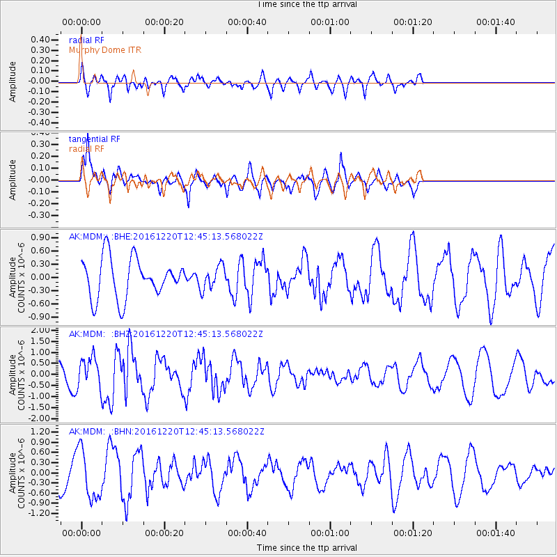
MDM Murphy Dome - Earthquake Result Viewer
*The percent match for this event was below the threshold and hence no stack was calculated.
| Earthquake location: |
Solomon Islands |
| Earthquake latitude/longitude: |
-10.2/160.9 |
| Earthquake time(UTC): |
2016/12/20 (355) 12:33:15 GMT |
| Earthquake Depth: |
12 km |
| Earthquake Magnitude: |
5.9 mb |
| Earthquake Catalog/Contributor: |
NEIC PDE/us |
|
| Network: |
AK Alaska Regional Network |
| Station: |
MDM Murphy Dome |
| Lat/Lon: |
64.96 N/148.23 W |
| Elevation: |
634 m |
|
| Distance: |
83.9 deg |
| Az: |
19.385 deg |
| Baz: |
230.158 deg |
| Ray Param: |
$rayparam |
*The percent match for this event was below the threshold and hence was not used in the summary stack. |
|
| Radial Match: |
41.99837 % |
| Radial Bump: |
400 |
| Transverse Match: |
51.881157 % |
| Transverse Bump: |
356 |
| SOD ConfigId: |
11737051 |
| Insert Time: |
2019-04-26 09:53:20.810 +0000 |
| GWidth: |
2.5 |
| Max Bumps: |
400 |
| Tol: |
0.001 |
|
Signal To Noise
| Channel | StoN | STA | LTA |
| AK:MDM: :BHZ:20161220T12:45:13.568022Z | 1.762011 | 6.7283077E-7 | 3.8185388E-7 |
| AK:MDM: :BHN:20161220T12:45:13.568022Z | 2.023316 | 7.429205E-7 | 3.6717967E-7 |
| AK:MDM: :BHE:20161220T12:45:13.568022Z | 0.58764184 | 2.6416427E-7 | 4.4953282E-7 |
| Arrivals |
| Ps | |
| PpPs | |
| PsPs/PpSs | |


