You are here: Home > Network List > CN - Canadian National Seismograph Network Stations List
> Station INK INUVIK, NT > Earthquake Result Viewer
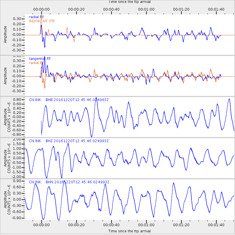
INK INUVIK, NT - Earthquake Result Viewer
*The percent match for this event was below the threshold and hence no stack was calculated.
| Earthquake location: |
Solomon Islands |
| Earthquake latitude/longitude: |
-10.2/160.9 |
| Earthquake time(UTC): |
2016/12/20 (355) 12:33:15 GMT |
| Earthquake Depth: |
12 km |
| Earthquake Magnitude: |
5.9 mb |
| Earthquake Catalog/Contributor: |
NEIC PDE/us |
|
| Network: |
CN Canadian National Seismograph Network |
| Station: |
INK INUVIK, NT |
| Lat/Lon: |
68.31 N/133.53 W |
| Elevation: |
44 m |
|
| Distance: |
90.6 deg |
| Az: |
19.784 deg |
| Baz: |
243.677 deg |
| Ray Param: |
$rayparam |
*The percent match for this event was below the threshold and hence was not used in the summary stack. |
|
| Radial Match: |
59.27154 % |
| Radial Bump: |
384 |
| Transverse Match: |
78.233345 % |
| Transverse Bump: |
400 |
| SOD ConfigId: |
11737051 |
| Insert Time: |
2019-04-26 09:55:07.019 +0000 |
| GWidth: |
2.5 |
| Max Bumps: |
400 |
| Tol: |
0.001 |
|
Signal To Noise
| Channel | StoN | STA | LTA |
| CN:INK: :BHZ:20161220T12:45:46.024993Z | 2.176821 | 1.2325404E-6 | 5.6621116E-7 |
| CN:INK: :BHN:20161220T12:45:46.024993Z | 2.439915 | 6.02808E-7 | 2.4706108E-7 |
| CN:INK: :BHE:20161220T12:45:46.024993Z | 2.022557 | 5.2001747E-7 | 2.5710892E-7 |
| Arrivals |
| Ps | |
| PpPs | |
| PsPs/PpSs | |


