You are here: Home > Network List > TA - USArray Transportable Network (new EarthScope stations) Stations List
> Station G21K Allakaket, AK, USA > Earthquake Result Viewer
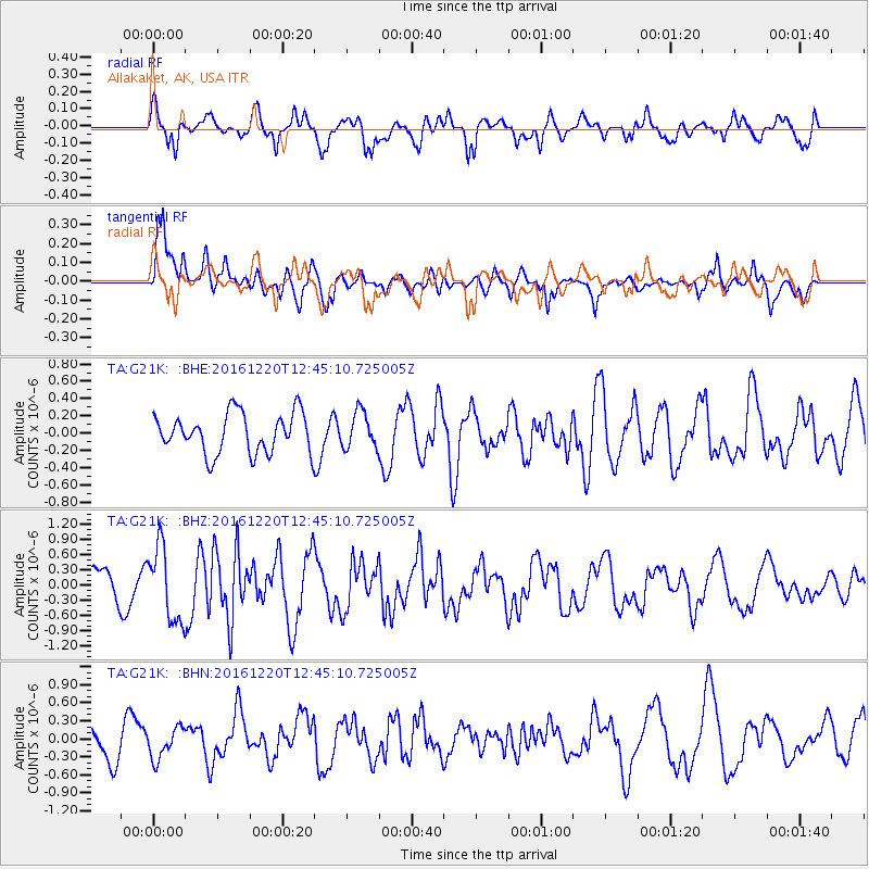
G21K Allakaket, AK, USA - Earthquake Result Viewer
*The percent match for this event was below the threshold and hence no stack was calculated.
| Earthquake location: |
Solomon Islands |
| Earthquake latitude/longitude: |
-10.2/160.9 |
| Earthquake time(UTC): |
2016/12/20 (355) 12:33:15 GMT |
| Earthquake Depth: |
12 km |
| Earthquake Magnitude: |
5.9 mb |
| Earthquake Catalog/Contributor: |
NEIC PDE/us |
|
| Network: |
TA USArray Transportable Network (new EarthScope stations) |
| Station: |
G21K Allakaket, AK, USA |
| Lat/Lon: |
66.52 N/153.51 W |
| Elevation: |
446 m |
|
| Distance: |
83.4 deg |
| Az: |
16.745 deg |
| Baz: |
225.058 deg |
| Ray Param: |
$rayparam |
*The percent match for this event was below the threshold and hence was not used in the summary stack. |
|
| Radial Match: |
60.525887 % |
| Radial Bump: |
400 |
| Transverse Match: |
61.008545 % |
| Transverse Bump: |
371 |
| SOD ConfigId: |
11737051 |
| Insert Time: |
2019-04-26 09:57:13.132 +0000 |
| GWidth: |
2.5 |
| Max Bumps: |
400 |
| Tol: |
0.001 |
|
Signal To Noise
| Channel | StoN | STA | LTA |
| TA:G21K: :BHZ:20161220T12:45:10.725005Z | 2.0554528 | 7.2713146E-7 | 3.537573E-7 |
| TA:G21K: :BHN:20161220T12:45:10.725005Z | 0.6481785 | 2.5888562E-7 | 3.9940483E-7 |
| TA:G21K: :BHE:20161220T12:45:10.725005Z | 0.9068666 | 2.0833669E-7 | 2.2973244E-7 |
| Arrivals |
| Ps | |
| PpPs | |
| PsPs/PpSs | |


