You are here: Home > Network List > TA - USArray Transportable Network (new EarthScope stations) Stations List
> Station R33M Jennings River, BC, CAN > Earthquake Result Viewer
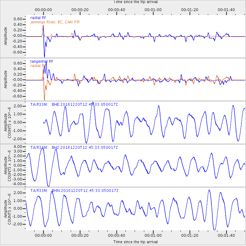
R33M Jennings River, BC, CAN - Earthquake Result Viewer
*The percent match for this event was below the threshold and hence no stack was calculated.
| Earthquake location: |
Solomon Islands |
| Earthquake latitude/longitude: |
-10.2/160.9 |
| Earthquake time(UTC): |
2016/12/20 (355) 12:33:15 GMT |
| Earthquake Depth: |
12 km |
| Earthquake Magnitude: |
5.9 mb |
| Earthquake Catalog/Contributor: |
NEIC PDE/us |
|
| Network: |
TA USArray Transportable Network (new EarthScope stations) |
| Station: |
R33M Jennings River, BC, CAN |
| Lat/Lon: |
59.39 N/130.97 W |
| Elevation: |
1437 m |
|
| Distance: |
87.9 deg |
| Az: |
28.365 deg |
| Baz: |
246.091 deg |
| Ray Param: |
$rayparam |
*The percent match for this event was below the threshold and hence was not used in the summary stack. |
|
| Radial Match: |
74.60613 % |
| Radial Bump: |
400 |
| Transverse Match: |
71.26582 % |
| Transverse Bump: |
385 |
| SOD ConfigId: |
11737051 |
| Insert Time: |
2019-04-26 09:57:33.220 +0000 |
| GWidth: |
2.5 |
| Max Bumps: |
400 |
| Tol: |
0.001 |
|
Signal To Noise
| Channel | StoN | STA | LTA |
| TA:R33M: :BHZ:20161220T12:45:33.050017Z | 2.4120982 | 3.1100608E-6 | 1.2893591E-6 |
| TA:R33M: :BHN:20161220T12:45:33.050017Z | 1.2157137 | 1.56403E-6 | 1.2865117E-6 |
| TA:R33M: :BHE:20161220T12:45:33.050017Z | 1.2480263 | 1.2908916E-6 | 1.0343466E-6 |
| Arrivals |
| Ps | |
| PpPs | |
| PsPs/PpSs | |


