You are here: Home > Network List > TA - USArray Transportable Network (new EarthScope stations) Stations List
> Station A36M Sachs Harbour, NT, CAN > Earthquake Result Viewer
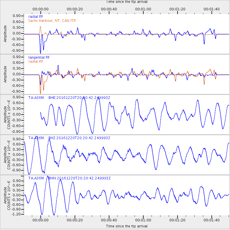
A36M Sachs Harbour, NT, CAN - Earthquake Result Viewer
*The percent match for this event was below the threshold and hence no stack was calculated.
| Earthquake location: |
Solomon Islands |
| Earthquake latitude/longitude: |
-10.2/160.8 |
| Earthquake time(UTC): |
2016/12/20 (355) 20:07:51 GMT |
| Earthquake Depth: |
3.9 km |
| Earthquake Magnitude: |
5.5 Mwb |
| Earthquake Catalog/Contributor: |
NEIC PDE/us |
|
| Network: |
TA USArray Transportable Network (new EarthScope stations) |
| Station: |
A36M Sachs Harbour, NT, CAN |
| Lat/Lon: |
71.99 N/125.25 W |
| Elevation: |
32 m |
|
| Distance: |
94.7 deg |
| Az: |
17.46 deg |
| Baz: |
251.707 deg |
| Ray Param: |
$rayparam |
*The percent match for this event was below the threshold and hence was not used in the summary stack. |
|
| Radial Match: |
66.9847 % |
| Radial Bump: |
400 |
| Transverse Match: |
67.94725 % |
| Transverse Bump: |
336 |
| SOD ConfigId: |
11737051 |
| Insert Time: |
2019-04-26 10:03:39.432 +0000 |
| GWidth: |
2.5 |
| Max Bumps: |
400 |
| Tol: |
0.001 |
|
Signal To Noise
| Channel | StoN | STA | LTA |
| TA:A36M: :BHZ:20161220T20:20:42.249993Z | 1.4826227 | 6.5615575E-7 | 4.4256421E-7 |
| TA:A36M: :BHN:20161220T20:20:42.249993Z | 2.345354 | 8.68395E-7 | 3.702618E-7 |
| TA:A36M: :BHE:20161220T20:20:42.249993Z | 1.6345049 | 7.351955E-7 | 4.4979706E-7 |
| Arrivals |
| Ps | |
| PpPs | |
| PsPs/PpSs | |


