You are here: Home > Network List > TA - USArray Transportable Network (new EarthScope stations) Stations List
> Station A21K Barrow, AK, USA > Earthquake Result Viewer
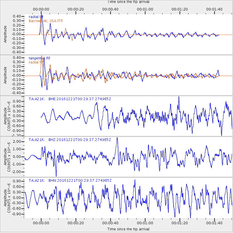
A21K Barrow, AK, USA - Earthquake Result Viewer
*The percent match for this event was below the threshold and hence no stack was calculated.
| Earthquake location: |
Banda Sea |
| Earthquake latitude/longitude: |
-7.5/127.9 |
| Earthquake time(UTC): |
2016/12/21 (356) 00:17:15 GMT |
| Earthquake Depth: |
152 km |
| Earthquake Magnitude: |
6.7 Mww |
| Earthquake Catalog/Contributor: |
NEIC PDE/us |
|
| Network: |
TA USArray Transportable Network (new EarthScope stations) |
| Station: |
A21K Barrow, AK, USA |
| Lat/Lon: |
71.32 N/156.62 W |
| Elevation: |
577 m |
|
| Distance: |
92.5 deg |
| Az: |
18.194 deg |
| Baz: |
253.925 deg |
| Ray Param: |
$rayparam |
*The percent match for this event was below the threshold and hence was not used in the summary stack. |
|
| Radial Match: |
64.84212 % |
| Radial Bump: |
400 |
| Transverse Match: |
54.314503 % |
| Transverse Bump: |
387 |
| SOD ConfigId: |
11737051 |
| Insert Time: |
2019-04-26 10:08:45.395 +0000 |
| GWidth: |
2.5 |
| Max Bumps: |
400 |
| Tol: |
0.001 |
|
Signal To Noise
| Channel | StoN | STA | LTA |
| TA:A21K: :BHZ:20161221T00:29:37.274985Z | 5.161343 | 7.118469E-7 | 1.3791893E-7 |
| TA:A21K: :BHN:20161221T00:29:37.274985Z | 0.8314906 | 2.2686208E-7 | 2.7283784E-7 |
| TA:A21K: :BHE:20161221T00:29:37.274985Z | 2.710655 | 5.3237653E-7 | 1.9640144E-7 |
| Arrivals |
| Ps | |
| PpPs | |
| PsPs/PpSs | |


