You are here: Home > Network List > TA - USArray Transportable Network (new EarthScope stations) Stations List
> Station I23K Minto, Yukon-Koyukuk, AK, USA > Earthquake Result Viewer
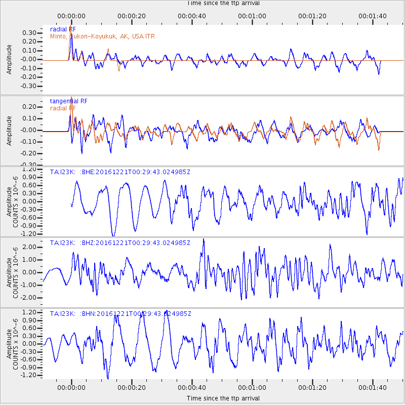
I23K Minto, Yukon-Koyukuk, AK, USA - Earthquake Result Viewer
*The percent match for this event was below the threshold and hence no stack was calculated.
| Earthquake location: |
Banda Sea |
| Earthquake latitude/longitude: |
-7.5/127.9 |
| Earthquake time(UTC): |
2016/12/21 (356) 00:17:15 GMT |
| Earthquake Depth: |
152 km |
| Earthquake Magnitude: |
6.7 Mww |
| Earthquake Catalog/Contributor: |
NEIC PDE/us |
|
| Network: |
TA USArray Transportable Network (new EarthScope stations) |
| Station: |
I23K Minto, Yukon-Koyukuk, AK, USA |
| Lat/Lon: |
65.15 N/149.36 W |
| Elevation: |
149 m |
|
| Distance: |
93.7 deg |
| Az: |
24.843 deg |
| Baz: |
260.31 deg |
| Ray Param: |
$rayparam |
*The percent match for this event was below the threshold and hence was not used in the summary stack. |
|
| Radial Match: |
61.84579 % |
| Radial Bump: |
400 |
| Transverse Match: |
56.54765 % |
| Transverse Bump: |
400 |
| SOD ConfigId: |
11737051 |
| Insert Time: |
2019-04-26 10:08:51.696 +0000 |
| GWidth: |
2.5 |
| Max Bumps: |
400 |
| Tol: |
0.001 |
|
Signal To Noise
| Channel | StoN | STA | LTA |
| TA:I23K: :BHZ:20161221T00:29:43.024985Z | 2.897243 | 8.6860047E-7 | 2.9980242E-7 |
| TA:I23K: :BHN:20161221T00:29:43.024985Z | 1.1983576 | 3.2284134E-7 | 2.6940316E-7 |
| TA:I23K: :BHE:20161221T00:29:43.024985Z | 0.82564795 | 4.6328833E-7 | 5.6112094E-7 |
| Arrivals |
| Ps | |
| PpPs | |
| PsPs/PpSs | |


