You are here: Home > Network List > AV - Alaska Volcano Observatory Stations List
> Station AMKA Regional Station, Amchitka Island, Alaska > Earthquake Result Viewer
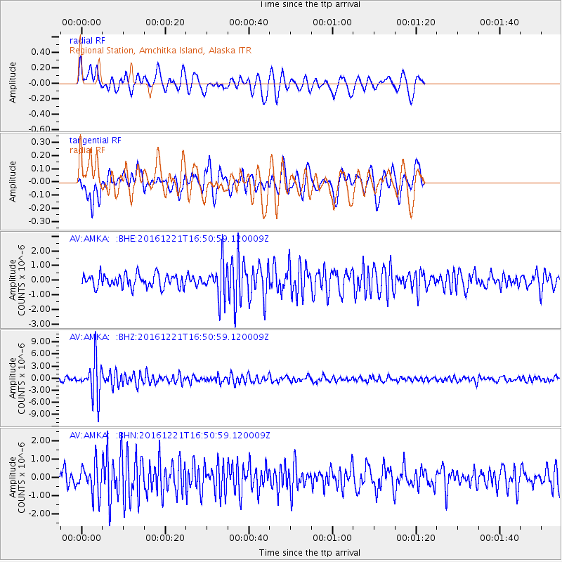
AMKA Regional Station, Amchitka Island, Alaska - Earthquake Result Viewer
*The percent match for this event was below the threshold and hence no stack was calculated.
| Earthquake location: |
Mariana Islands Region |
| Earthquake latitude/longitude: |
21.5/145.4 |
| Earthquake time(UTC): |
2016/12/21 (356) 16:43:58 GMT |
| Earthquake Depth: |
17 km |
| Earthquake Magnitude: |
5.9 Mwb |
| Earthquake Catalog/Contributor: |
NEIC PDE/us |
|
| Network: |
AV Alaska Volcano Observatory |
| Station: |
AMKA Regional Station, Amchitka Island, Alaska |
| Lat/Lon: |
51.38 N/179.30 E |
| Elevation: |
116 m |
|
| Distance: |
39.8 deg |
| Az: |
33.135 deg |
| Baz: |
234.296 deg |
| Ray Param: |
$rayparam |
*The percent match for this event was below the threshold and hence was not used in the summary stack. |
|
| Radial Match: |
70.27116 % |
| Radial Bump: |
400 |
| Transverse Match: |
55.127872 % |
| Transverse Bump: |
400 |
| SOD ConfigId: |
11737051 |
| Insert Time: |
2019-04-26 10:13:14.612 +0000 |
| GWidth: |
2.5 |
| Max Bumps: |
400 |
| Tol: |
0.001 |
|
Signal To Noise
| Channel | StoN | STA | LTA |
| AV:AMKA: :BHZ:20161221T16:50:59.120009Z | 9.96073 | 4.4272274E-6 | 4.4446818E-7 |
| AV:AMKA: :BHN:20161221T16:50:59.120009Z | 2.1881397 | 8.2306696E-7 | 3.761492E-7 |
| AV:AMKA: :BHE:20161221T16:50:59.120009Z | 2.6968472 | 1.1712799E-6 | 4.3431456E-7 |
| Arrivals |
| Ps | |
| PpPs | |
| PsPs/PpSs | |


