You are here: Home > Network List > AZ - ANZA Regional Network Stations List
> Station SMER AZ.SMER > Earthquake Result Viewer
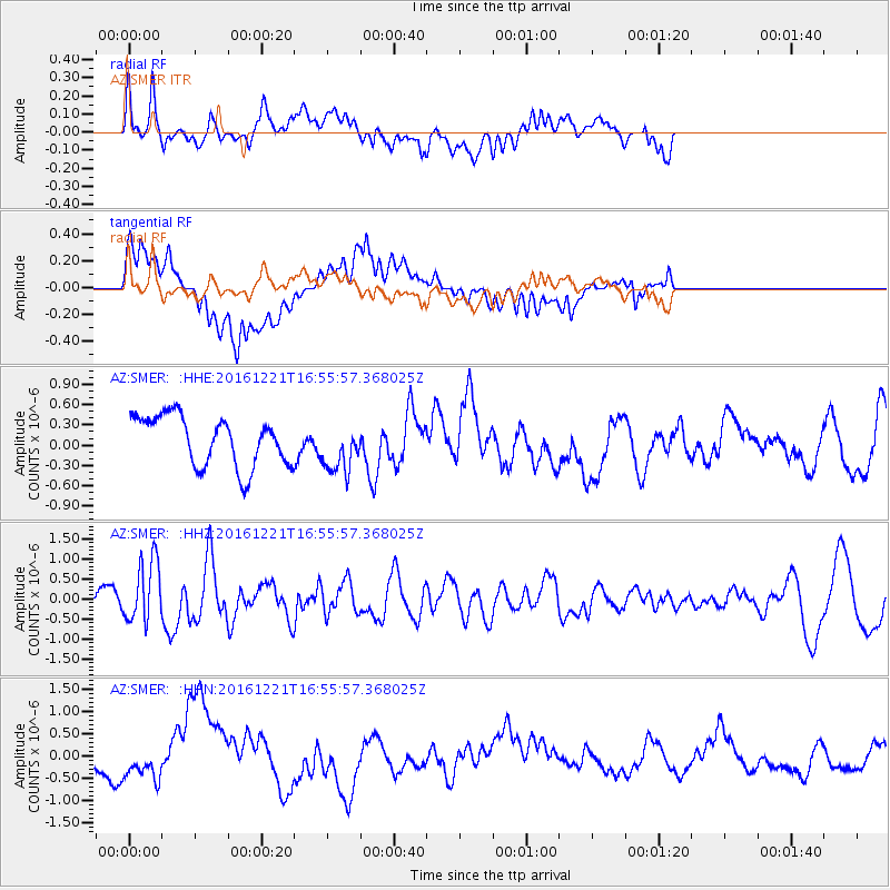
SMER AZ.SMER - Earthquake Result Viewer
*The percent match for this event was below the threshold and hence no stack was calculated.
| Earthquake location: |
Mariana Islands Region |
| Earthquake latitude/longitude: |
21.5/145.4 |
| Earthquake time(UTC): |
2016/12/21 (356) 16:43:58 GMT |
| Earthquake Depth: |
17 km |
| Earthquake Magnitude: |
5.9 Mwb |
| Earthquake Catalog/Contributor: |
NEIC PDE/us |
|
| Network: |
AZ ANZA Regional Network |
| Station: |
SMER AZ.SMER |
| Lat/Lon: |
33.46 N/117.17 W |
| Elevation: |
355 m |
|
| Distance: |
84.3 deg |
| Az: |
56.414 deg |
| Baz: |
291.904 deg |
| Ray Param: |
$rayparam |
*The percent match for this event was below the threshold and hence was not used in the summary stack. |
|
| Radial Match: |
51.353268 % |
| Radial Bump: |
400 |
| Transverse Match: |
58.072067 % |
| Transverse Bump: |
400 |
| SOD ConfigId: |
11737051 |
| Insert Time: |
2019-04-26 10:13:44.289 +0000 |
| GWidth: |
2.5 |
| Max Bumps: |
400 |
| Tol: |
0.001 |
|
Signal To Noise
| Channel | StoN | STA | LTA |
| AZ:SMER: :HHZ:20161221T16:55:57.368025Z | 3.782839 | 7.80265E-7 | 2.0626439E-7 |
| AZ:SMER: :HHN:20161221T16:55:57.368025Z | 1.0774697 | 3.1387964E-7 | 2.913118E-7 |
| AZ:SMER: :HHE:20161221T16:55:57.368025Z | 0.95909095 | 3.5334384E-7 | 3.6841536E-7 |
| Arrivals |
| Ps | |
| PpPs | |
| PsPs/PpSs | |


