You are here: Home > Network List > CI - Caltech Regional Seismic Network Stations List
> Station MPM Manuel Prospect Mine, California, USA > Earthquake Result Viewer
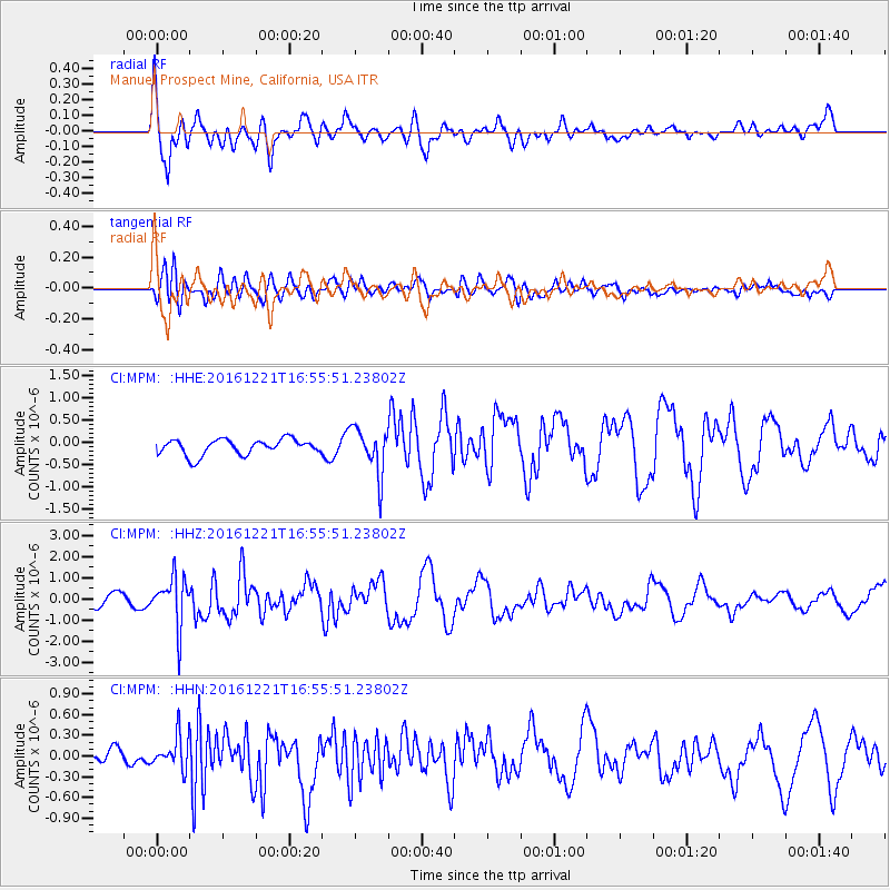
MPM Manuel Prospect Mine, California, USA - Earthquake Result Viewer
*The percent match for this event was below the threshold and hence no stack was calculated.
| Earthquake location: |
Mariana Islands Region |
| Earthquake latitude/longitude: |
21.5/145.4 |
| Earthquake time(UTC): |
2016/12/21 (356) 16:43:58 GMT |
| Earthquake Depth: |
17 km |
| Earthquake Magnitude: |
5.9 Mwb |
| Earthquake Catalog/Contributor: |
NEIC PDE/us |
|
| Network: |
CI Caltech Regional Seismic Network |
| Station: |
MPM Manuel Prospect Mine, California, USA |
| Lat/Lon: |
36.06 N/117.49 W |
| Elevation: |
185 m |
|
| Distance: |
83.1 deg |
| Az: |
54.086 deg |
| Baz: |
291.468 deg |
| Ray Param: |
$rayparam |
*The percent match for this event was below the threshold and hence was not used in the summary stack. |
|
| Radial Match: |
78.273796 % |
| Radial Bump: |
400 |
| Transverse Match: |
82.31892 % |
| Transverse Bump: |
400 |
| SOD ConfigId: |
11737051 |
| Insert Time: |
2019-04-26 10:14:52.174 +0000 |
| GWidth: |
2.5 |
| Max Bumps: |
400 |
| Tol: |
0.001 |
|
Signal To Noise
| Channel | StoN | STA | LTA |
| CI:MPM: :HHZ:20161221T16:55:51.23802Z | 4.0755897 | 1.1623762E-6 | 2.852044E-7 |
| CI:MPM: :HHN:20161221T16:55:51.23802Z | 2.2318776 | 2.3629599E-7 | 1.05873184E-7 |
| CI:MPM: :HHE:20161221T16:55:51.23802Z | 3.0074842 | 5.279573E-7 | 1.7554783E-7 |
| Arrivals |
| Ps | |
| PpPs | |
| PsPs/PpSs | |


