You are here: Home > Network List > CN - Canadian National Seismograph Network Stations List
> Station INK INUVIK, NT > Earthquake Result Viewer
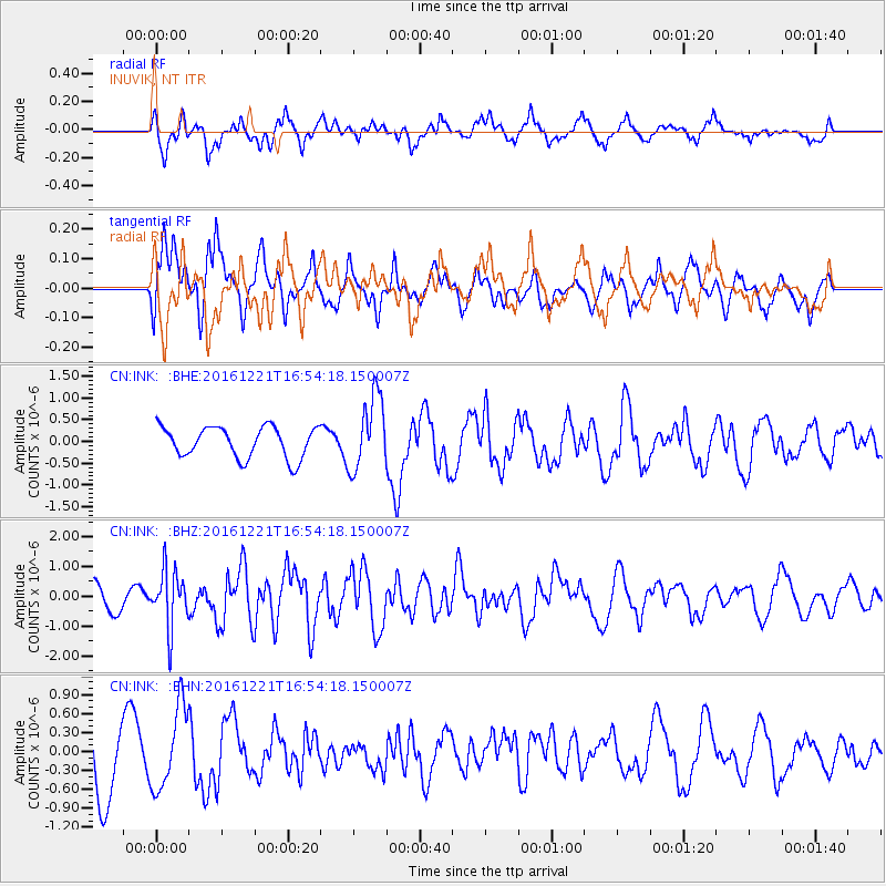
INK INUVIK, NT - Earthquake Result Viewer
*The percent match for this event was below the threshold and hence no stack was calculated.
| Earthquake location: |
Mariana Islands Region |
| Earthquake latitude/longitude: |
21.5/145.4 |
| Earthquake time(UTC): |
2016/12/21 (356) 16:43:58 GMT |
| Earthquake Depth: |
17 km |
| Earthquake Magnitude: |
5.9 Mwb |
| Earthquake Catalog/Contributor: |
NEIC PDE/us |
|
| Network: |
CN Canadian National Seismograph Network |
| Station: |
INK INUVIK, NT |
| Lat/Lon: |
68.31 N/133.53 W |
| Elevation: |
44 m |
|
| Distance: |
66.9 deg |
| Az: |
23.535 deg |
| Baz: |
270.113 deg |
| Ray Param: |
$rayparam |
*The percent match for this event was below the threshold and hence was not used in the summary stack. |
|
| Radial Match: |
65.3488 % |
| Radial Bump: |
400 |
| Transverse Match: |
56.32518 % |
| Transverse Bump: |
400 |
| SOD ConfigId: |
11737051 |
| Insert Time: |
2019-04-26 10:15:24.621 +0000 |
| GWidth: |
2.5 |
| Max Bumps: |
400 |
| Tol: |
0.001 |
|
Signal To Noise
| Channel | StoN | STA | LTA |
| CN:INK: :BHZ:20161221T16:54:18.150007Z | 2.6313393 | 9.548372E-7 | 3.6287116E-7 |
| CN:INK: :BHN:20161221T16:54:18.150007Z | 1.2294594 | 6.476501E-7 | 5.267763E-7 |
| CN:INK: :BHE:20161221T16:54:18.150007Z | 2.3678303 | 8.439074E-7 | 3.5640537E-7 |
| Arrivals |
| Ps | |
| PpPs | |
| PsPs/PpSs | |


