
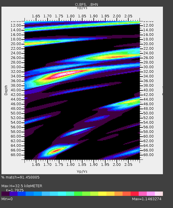
BFS Mt Baldy Forest Station - Earthquake Result Viewer
| ||||||||||||||||||
| ||||||||||||||||||
| ||||||||||||||||||
|
Signal To Noise
| Channel | StoN | STA | LTA |
| CI:BFS: :BHN:20041023T09:07:35.195022Z | 1.6627307 | 2.5129265E-7 | 1.511325E-7 |
| CI:BFS: :BHE:20041023T09:07:35.195022Z | 2.7360213 | 5.3568704E-7 | 1.9579052E-7 |
| CI:BFS: :BHZ:20041023T09:07:35.195022Z | 8.673224 | 2.0370665E-6 | 2.3486841E-7 |
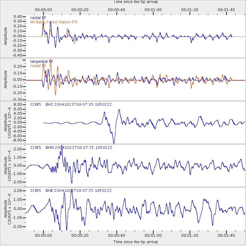
| Arrivals | |
| Ps | 4.2 SECOND |
| PpPs | 14 SECOND |
| PsPs/PpSs | 18 SECOND |

