BFS Mt Baldy Forest Station - Earthquake Result Viewer
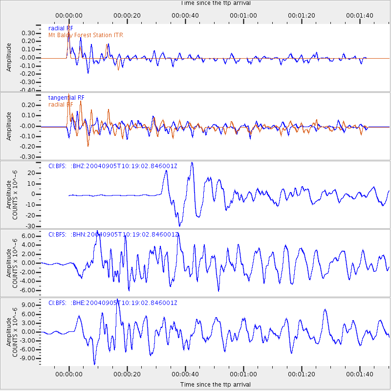
Earthquake location: Near S. Coast Of Western Honshu
Earthquake latitude/longitude: 33.1/136.6
Earthquake time(UTC): 2004/09/05 (249) 10:07:07 GMT
Earthquake Depth: 14 km
Earthquake Magnitude: 6.7 MB, 7.0 MS, 7.2 MW, 7.0 MW
Earthquake Catalog/Contributor: WHDF/NEIC
Network: CI Caltech Regional Seismic Network
Station: BFS Mt Baldy Forest Station
Lat/Lon: 34.24 N/117.66 W
Elevation: 1312 m
Distance: 83.4 deg
Az: 53.402 deg
Baz: 305.54 deg
Ray Param: 0.046237715
Estimated Moho Depth: 34.25 km
Estimated Crust Vp/Vs: 1.74
Assumed Crust Vp: 6.276 km/s
Estimated Crust Vs: 3.607 km/s
Estimated Crust Poisson's Ratio: 0.25
Radial Match: 91.62029 %
Radial Bump: 400
Transverse Match: 89.021095 %
Transverse Bump: 400
SOD ConfigId: 2459
Insert Time: 2010-03-05 20:51:27.088 +0000
GWidth: 2.5
Max Bumps: 400
Tol: 0.001

Signal To Noise

ChannelStoNSTALTA
CI:BFS: :BHN:20040905T10:19:02.846001Z3.4226261.4677657E-64.2884196E-7
CI:BFS: :BHE:20040905T10:19:02.846001Z8.8172792.6596163E-63.0163685E-7
CI:BFS: :BHZ:20040905T10:19:02.846001Z38.5151061.0428779E-52.7077112E-7
Arrivals
Ps4.1 SECOND
PpPs15 SECOND
PsPs/PpSs19 SECOND