You are here: Home > Network List > TA - USArray Transportable Network (new EarthScope stations) Stations List
> Station 121A Cookes Peak, Deming, NM, USA > Earthquake Result Viewer
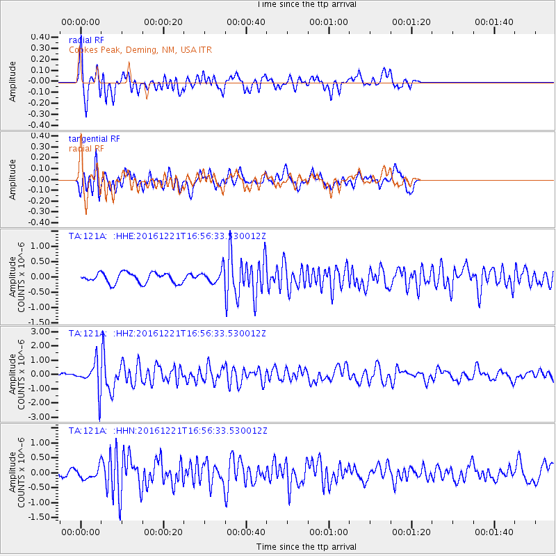
121A Cookes Peak, Deming, NM, USA - Earthquake Result Viewer
*The percent match for this event was below the threshold and hence no stack was calculated.
| Earthquake location: |
Mariana Islands Region |
| Earthquake latitude/longitude: |
21.5/145.4 |
| Earthquake time(UTC): |
2016/12/21 (356) 16:43:58 GMT |
| Earthquake Depth: |
17 km |
| Earthquake Magnitude: |
5.9 Mwb |
| Earthquake Catalog/Contributor: |
NEIC PDE/us |
|
| Network: |
TA USArray Transportable Network (new EarthScope stations) |
| Station: |
121A Cookes Peak, Deming, NM, USA |
| Lat/Lon: |
32.53 N/107.79 W |
| Elevation: |
1652 m |
|
| Distance: |
91.9 deg |
| Az: |
53.994 deg |
| Baz: |
296.918 deg |
| Ray Param: |
$rayparam |
*The percent match for this event was below the threshold and hence was not used in the summary stack. |
|
| Radial Match: |
74.24157 % |
| Radial Bump: |
383 |
| Transverse Match: |
63.767498 % |
| Transverse Bump: |
400 |
| SOD ConfigId: |
11737051 |
| Insert Time: |
2019-04-26 10:19:26.329 +0000 |
| GWidth: |
2.5 |
| Max Bumps: |
400 |
| Tol: |
0.001 |
|
Signal To Noise
| Channel | StoN | STA | LTA |
| TA:121A: :HHZ:20161221T16:56:33.530012Z | 6.5178313 | 1.0427931E-6 | 1.599908E-7 |
| TA:121A: :HHN:20161221T16:56:33.530012Z | 0.65133834 | 2.0061452E-7 | 3.0800356E-7 |
| TA:121A: :HHE:20161221T16:56:33.530012Z | 1.8472387 | 3.108384E-7 | 1.6827192E-7 |
| Arrivals |
| Ps | |
| PpPs | |
| PsPs/PpSs | |


