You are here: Home > Network List > TA - USArray Transportable Network (new EarthScope stations) Stations List
> Station G22K Bettles, AK, USA > Earthquake Result Viewer
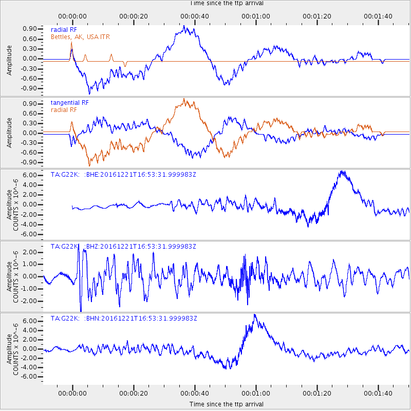
G22K Bettles, AK, USA - Earthquake Result Viewer
*The percent match for this event was below the threshold and hence no stack was calculated.
| Earthquake location: |
Mariana Islands Region |
| Earthquake latitude/longitude: |
21.5/145.4 |
| Earthquake time(UTC): |
2016/12/21 (356) 16:43:58 GMT |
| Earthquake Depth: |
17 km |
| Earthquake Magnitude: |
5.9 Mwb |
| Earthquake Catalog/Contributor: |
NEIC PDE/us |
|
| Network: |
TA USArray Transportable Network (new EarthScope stations) |
| Station: |
G22K Bettles, AK, USA |
| Lat/Lon: |
66.92 N/151.51 W |
| Elevation: |
205 m |
|
| Distance: |
59.9 deg |
| Az: |
23.975 deg |
| Baz: |
253.678 deg |
| Ray Param: |
$rayparam |
*The percent match for this event was below the threshold and hence was not used in the summary stack. |
|
| Radial Match: |
39.2365 % |
| Radial Bump: |
400 |
| Transverse Match: |
41.096508 % |
| Transverse Bump: |
400 |
| SOD ConfigId: |
11737051 |
| Insert Time: |
2019-04-26 10:19:44.996 +0000 |
| GWidth: |
2.5 |
| Max Bumps: |
400 |
| Tol: |
0.001 |
|
Signal To Noise
| Channel | StoN | STA | LTA |
| TA:G22K: :BHZ:20161221T16:53:31.999983Z | 5.1964025 | 1.4948811E-6 | 2.8767613E-7 |
| TA:G22K: :BHN:20161221T16:53:31.999983Z | 1.7196268 | 6.242549E-7 | 3.6301765E-7 |
| TA:G22K: :BHE:20161221T16:53:31.999983Z | 1.8801349 | 7.043715E-7 | 3.7463877E-7 |
| Arrivals |
| Ps | |
| PpPs | |
| PsPs/PpSs | |


