
BFS Mt Baldy Forest Station - Earthquake Result Viewer
| ||||||||||||||||||
| ||||||||||||||||||
| ||||||||||||||||||
|
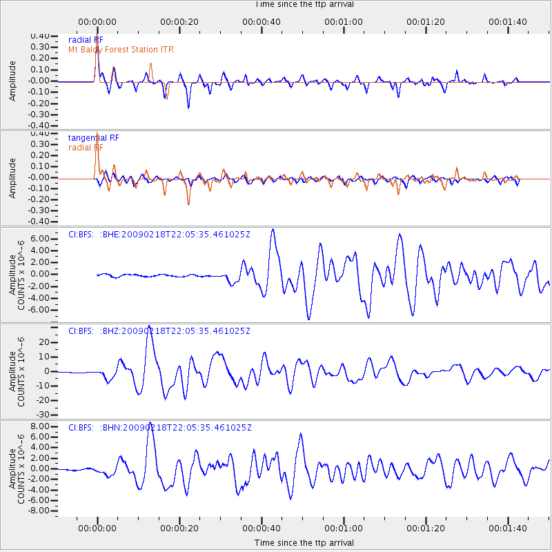
Signal To Noise
| Channel | StoN | STA | LTA |
| CI:BFS: :BHZ:20090218T22:05:35.461025Z | 10.250956 | 3.4133332E-6 | 3.3297707E-7 |
| CI:BFS: :BHN:20090218T22:05:35.461025Z | 6.020187 | 7.862739E-7 | 1.3060622E-7 |
| CI:BFS: :BHE:20090218T22:05:35.461025Z | 4.912916 | 9.056349E-7 | 1.8433754E-7 |
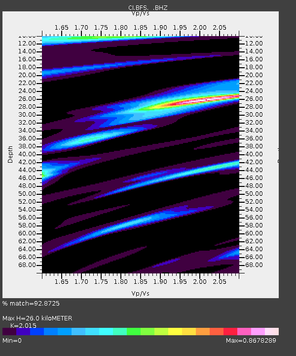
| Arrivals | |
| Ps | 4.3 SECOND |
| PpPs | 12 SECOND |
| PsPs/PpSs | 17 SECOND |

