
BFS Mt Baldy Forest Station - Earthquake Result Viewer
| ||||||||||||||||||
| ||||||||||||||||||
| ||||||||||||||||||
|
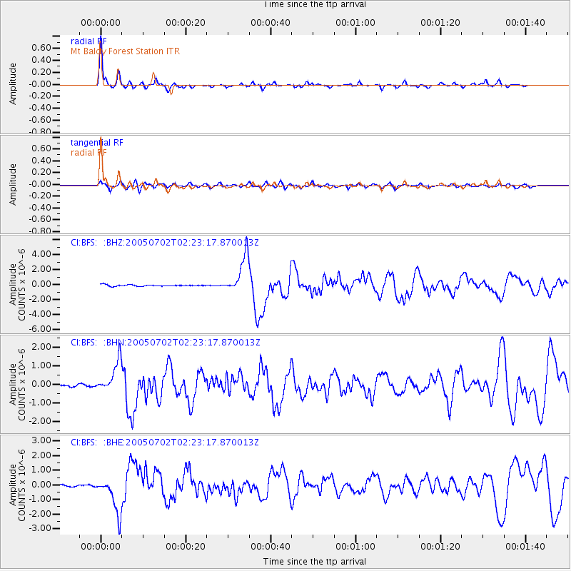
Signal To Noise
| Channel | StoN | STA | LTA |
| CI:BFS: :BHN:20050702T02:23:17.870013Z | 14.718616 | 8.7376185E-7 | 5.9364403E-8 |
| CI:BFS: :BHE:20050702T02:23:17.870013Z | 20.18751 | 1.2591325E-6 | 6.237186E-8 |
| CI:BFS: :BHZ:20050702T02:23:17.870013Z | 28.420675 | 2.557963E-6 | 9.000359E-8 |
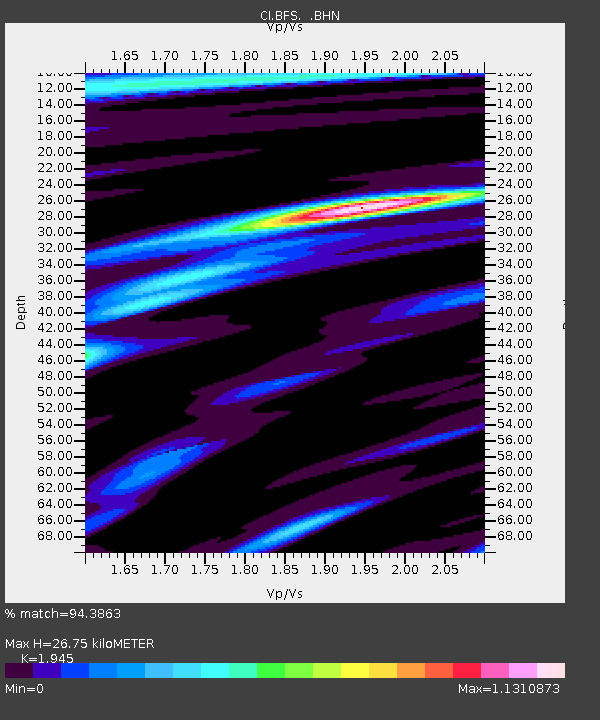
| Arrivals | |
| Ps | 4.3 SECOND |
| PpPs | 12 SECOND |
| PsPs/PpSs | 16 SECOND |

