
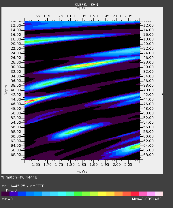
BFS Mt Baldy Forest Station - Earthquake Result Viewer
| ||||||||||||||||||
| ||||||||||||||||||
| ||||||||||||||||||
|
Signal To Noise
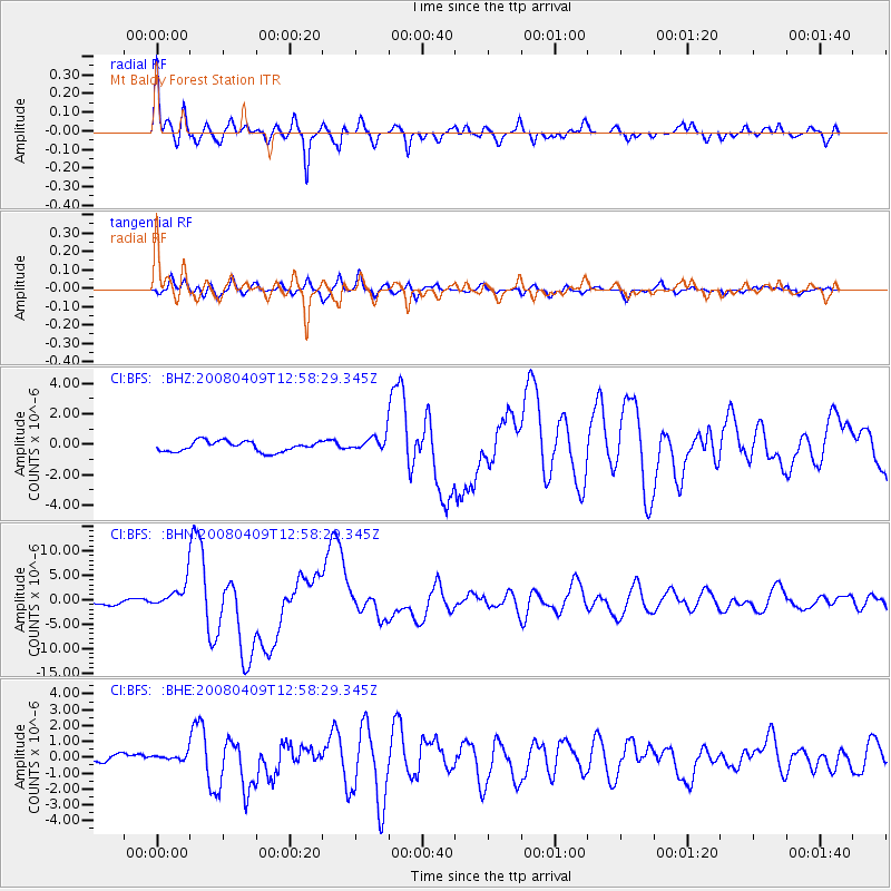
| Channel | StoN | STA | LTA |
| CI:BFS: :BHN:20080409T12:58:29.345Z | 7.564398 | 2.637601E-6 | 3.4868617E-7 |
| CI:BFS: :BHE:20080409T12:58:29.345Z | 0.9294807 | 2.1144386E-7 | 2.2748601E-7 |
| CI:BFS: :BHZ:20080409T12:58:29.345Z | 1.4949203 | 5.0712185E-7 | 3.3923004E-7 |
| Arrivals | |
| Ps | 4.4 SECOND |
| PpPs | 18 SECOND |
| PsPs/PpSs | 23 SECOND |

